¬ Exploring Taiwan's history, culture and languages through its place names
Monday 31 January 2022
Guan Yu (關羽)
Guan Yu (關羽) was a Chinese general who lived at the end of the Eastern Han dynasty (東漢; 25~220 CE). He fought primarily for warlord Liu Bei (劉備), to whom, along with Zhang Fei (張飛), he swore allegiance, and assisted him to found the state of Shu (蜀) during the Three Kingdoms Period (三國時代; 220~280). He was eventually captured by Sun Quan's (孫權) forces of the state of Wu (吳) and executed.
He was reputed for his loyalty and worshipped as a deity, being formally inducted into the Daoist pantheon some 400 years after his death in 220 CE, as well as being adopted by folk Buddhism as a boddhisattva.
Over subsequent centuries, the myths surrounding Guan Yu's exploits proliferated, culminating in the 14th-century novel "Romance of the Three Kingdoms" (三國演義), and leading to his further enhancement as a paradigm of loyalty and righteousness.
He is worshipped by Chinese people around the world, often by the names of Guan Gong (關公; "Duke Guan"), Guan Di (關帝; "Emperor Guan") and so forth. As the patron deity of business people, small statues of him are found in shops and restaurants. At folk / Daoist temples, he frequently appears as a door god to ward off evil spirits, often with Zhang Fei. Guan Yu is easily recognized by his beard and often red face, and by his weapon of choice a 偃月刀 (Mdn. yanyuedao; lit. "supine [cresent] moon blade"), which is more commonly known as a 關刀 (Mdn. Guan dao; lit. "Guan's blade").
Copyright Jiyue Publications 2022
Sunday 30 January 2022
Checheng (車城) Township, Pingtung County
Checheng (車城; lit. "Vehicle City") was formerly Paiwan aboriginal territory known as Kabeyawan, which was transliterated by Han-Chinese immigrants as 龜壁灣(Hoklo: Ku-piah-wan; Mdn. Guibiwan; lit. "Turtle Wall Bay").
After Koxinga ejected the Dutch from southwestern Taiwan and established the Zheng-family Tongning Kingdom, his son, Zheng Jing (鄭經; r.1662~81) sent soldiers to set up a garrison-farm in this area. Over time, this attracted other immigrants and gradually became a village known as 統領埔 (Mdn. Tonglingpu; lit. "Commander's Plain").
During the Qing dynasty (1683~1895) as aborigines sought to take back their lands, wooden fences were built, for which the township became known as 柴城 (Mdn. Chaicheng; lit. "Firewood Wall"). As to how this transformed into 車城 is not clear, a couple of possible explanations are (source here):
i) carts (車) filled with charcoal were used to defend the town against aboriginal attack; or [MC: more plausibly, surely]
ii) 柴城 was pronounced something like Tsa-siaⁿ in Hoklo Taiwanese, which was similar to the pronunciation of 車城 in the Hakka language used by many families in this area.
Copyright Jiyue Publications 2022
Tucheng (土城) District, New Taipei City
Tucheng (土城; lit. "Earthen [City] Wall") derived from exactly what it means, an embankment of earth constructed around a community. In this case, as elsewhere in Taiwan, it was intended to defend immigrant Han-Chinese from aborigines, who presumably were not happy about encroachment into their traditional territories.
Abe Akiyoshi (安倍明義) in his 台灣地名研究 ("Studies on Taiwan's Place Names"; 1938) lists as names deriving from features constructed to protect against attack from aborigines:
i) 土城 (Mdn. tu-cheng; lit. earthen wall");
ii) 土牛 (Mdn. tu-niu; lit. "earthen ox" - because piled up earth looked like a line of oxen sitting down);
iii) 石城 (Mdn. shi-cheng; lit. "stone wall"); see Shicheng (石城), Yilan;
iv) 石圍 (Mdn. shi-wei; lit. "stone enclosure");
v) 木柵 (Mdn. mu-zha; lit. "wooden fence"); see Muzha (木柵), Wenshan District, Taipei City;
vi) 柴城 (Mdn. chai-cheng; lit. "firewood wall", but probably similar to 木柵); see Checheng (車城) Township, Pingtung;
vii) 銃櫃 (Mdn. chong-gui; lit. "gun cabinet"); and
viii) 隘寮 (Mdn. ai-liao; lit. "pass office", which were constructed at each pass where aborigines could enter immigrant areas from the "Barbarian Territories"); see Jiji (集集) Township, Nantou.
The list does not include the very widespread 竹圍 (Mdn. zhu-wei; lit. "bamboo enclosure"), however, which Abe explains as a means of protecting against the wind rather than aborigines.
Copyright Jiyue Publications 2022
Saturday 29 January 2022
Qishan River (旗山溪)
Qishan River (旗山溪; lit. “Flag Mountain River) flows through Chiayi, Kaohsiung and Pingtung for 117 km before entering the Gaoping River (高屏溪). It is also known by its earlier name of 楠梓仙溪 (Mdn. Nanzixian River), though its Hoklo pronunciation of something like Lam-tsu-sian suggests this may be a transliteration of the older Tsou aboriginal name for the river and hence the lands around it in today’s Kaohsiung City and, since 2008, for the local Namasiya District.
The Liberty Times records a Kanakanavu (卡那卡那富; formerly considered a subgroup of the Tsou, now recognized as an individual and independent ethnic group of around 400 people) legend: Hundreds of years ago, a 15-year-old boy named Namasiya finds a giant mottled eel (鱸鰻) blocking the river, endangering his whole tribe. Hurrying back to the village he informs them of the problem but, due to fright he fell ill and died a few days later. Tribespeople join forces with a wild boar to kill the eel, relieve the problem, and for a long time afterwards they gave up hunting boars.
Copyright Jiyue Publications 2022
Namasiya (那瑪夏) District, Kaohsiung City
Being somewhat isolated and inaccessible in the mountains of southern Taiwan, aboriginal Maya Township had managed to maintain its independence and, with that, its traditional name, long after most others had lost theirs.
Thus, even after 17th-century Dutch colonial activities based in not-so-far-away Tayouan (Tainan); Han-Chinese territorial expansion throughout the 17th-century Zheng-family’s Tongning Kingdom and 18th- & 19th-century Qing dynasty; and even the ultimately complete rule over Taiwan by the Japanese, this area had managed to retain its indigenous name of Maya, albeit transliterated into Chinese as 瑪雅 (Mdn. Ma-ya).
This ended in 1957, however, when the KMT-led ROC government decided to bring order and civilization to the “Mountain People” (山地人), which included changing the township’s name to Sanmin (三民; “Three People[‘s Principles]”; see here), based on the political philosophy proposed by “Father of the Nation”, Dr. Sun Yat-sen. Furthermore, its three villages were renamed after each of the principles: Minzu (民族; “People’s Nationalism”), Minquan (民權; People’s Rights) and Minsheng (民生; “People’s Livelihood”).
Despite some Han-Chinese immigration, most inhabitants were still Aborigines (though the previously predominant Tsuo 鄒 ethnicity had been reduced by epidemics and replaced somewhat by Bunun 布農 people). Thus 50 years later, when legal changes under the DPP-led central government allowed them to campaign to change the township’s name, members of the local council voted unanimously to rid themselves of the Sanmin moniker (see Taipei Times).
Instead, from January 1, 2008, the county township (later reorganized as a city district) would be known as Namasiya (那瑪夏) and its three villages as Nanisaru (南沙魯), Maya (瑪雅) and Takanuwa (塔卡努瓦). “Namasiya” was the original Tsou ( or Kanakanvu) name for Nanzihsian River (楠梓仙溪) (now officially 旗山溪 Qishan River) and, therefore, the land around it. In addition, it sounds similar to a Bunun expression meaning “Tomorrow will be better”. Copyright Jiyue Publications 2022
Friday 28 January 2022
Sanmin (三民) District, Kaohsiung City
Like many streets, villages and other places throughout Taiwan, Kaohsiung’s Sanmin (三民; lit. “Three People(s)”) is an abbreviated form of Sanmin Zhuyi (三民主義; the “Three Principles of the People”), the political philospohy espoused by Dr. Sun Yat-sen (孫逸仙) and later promoted in Taiwan by the KMT-led ROC government, particularly in the period before the first hand-over of presidential and central government power to an opposition party in 2000 (for more details, see San Min Zhuyi).
But Sanmin District in Kaohsiung has a somewhat older pedigree. From the 17th century until arrival of the KMT in the middle of the 20th century, its “three peoples” were the Wang (王), Tsai (蔡) and Zheng (鄭; often romanized as Cheng) families who had first immigrated to this area and built their homes here, for which it had been known for more than 300 years as 三塊厝 (Hoklo Sam-de-tsu; Mdn. Sankuaicuo ; lit. “Three Houses”).
In the postwar period, in order to “create a model district of the Three Principles of the People”, Sankuaicuo was combined with 6 neighboring areas to create Sanmin Township (now District). According to Wikipedia, these others were 大港 (lit. “Great Harbor”), 灣子內 (lit. “Within the Bay”), 寶珠溝 (lit. “Precious Bead Ditch”), 獅頭 (lit. “Lion’s Head”), 本館 (lit. “Original Mansion”) and 覆鼎金(lit. “Covered Tripod Gold”).
There was also a Sanmin Township (三民鄉) in Kaohsiung County (which merged with Kaohsiung City in 2010) but in 2008, after a campaign by its residents, most of whom are Bunun (布農), Kanakanavu (卡那卡那富), Hla’alua (拉阿魯哇; formerly considered a subgroup of Tsou 鄒) and Paiwan (排灣) aboringines, this “overly political’ name was changed to Namasiya (那瑪夏; see here).
Copyright Jiyue Publications 2022
The Three Principles of the People (三民主義 Mdn. San Min Zhuyi) is a political philosophy developed by Dr. Sun Yat-sen (孫逸仙; SYS) and adopted and widely promoted by the Chinese Nationalist Party (中國國民黨; KMT), particularly by Chiang Kai-shek (蔣介石; CKS) and particularly in the period following defeat in the Chinese Civil War and KMT's relocation to Taiwan. As such it is quoted as the first line as the ROC national anthem, and it, as well as its three constituant parts, were used to rename numerous towns, villages and streets around the country.
Also very numerous have been the Master’s and PhD theses written discussing what SYS meant, or could have meant, or should have meant by his Three Principles. The first two inspired, he said, by Abraham Lincoln’s “government of the people, by the people, for the people”; the third by social welfare policies he witnessed in European countries during his travels to garner support for opposition to the Qing imperial state.
i) The 民族主義 (Mdn. Minzu Zhuyi), literally meaning something like “principle of [government] of the people(s)”, is usually translated as “nationalism”, since SYS clearly had the Chinese nation in mind, as opposed to the narrow Manchurian-led Qing court which, at least in part, stayed in power though promoting division between all other ethniciites.
Through this principle, he sought to promote commn cause, a “national consciousness”, for all of China’s diverse ethnicities, primarily composed of the “five main groups” (Han, Manchurian, Mongol, Hui (Muslims) and Tibetan ; [MC: as usual the “minority peoples” seem to be overlooked, just as Taiwan’s dozens of indigenous peoples would be half a century later]), who together were symbolized on the Five Color Flag of the early ROC (1911–1928). In short, SYS’s Principle of the Peoples was based on the idea that China’s various peoples had more that united them than divided them, that they were stronger together.
ii) The 民權主義 (Mdn. Minquan Zhuyi), literally meaning “principle of people’s rights”, that is, of “people power” or, in other words, of “government by the people(s)”, which is consequently usually translated as “democracy”.
From this simple statement of principle, SYS (and the generations after him) set about defining these powers / rights (election, recall, initiative and referendum) and working out how these could be applied through various institutions / branches (legislative, executive, judicial, control and examination) to create a fair and effective system of government.
iii) The 民生主義 Mdn. Minsheng Zhuyi), literally meaning “principle of people’s livelihood”, is therefore, “government for the people”, and is often translated as “livelihood” or “social welfare”. It was somthing of an afterthought from SYS, but, being rather socialist in nature, at least in the way he interpreted it, as well as the direction in which he initially led the KMT, made it perhaps the most radical of the Three Principles. It is also perhaps why it is the most disputed and, some would argue, the most ignored.
The strengths of the Three Principles of the People is evidenced, not just in that they were also prasied by the Chinese Communist Party (although, of course, its definitions of “people’s rights” and “people’s livelihood” in particular differ greatly from those of the KMT), but also in that in Taiwan’s post-martial law, multi-party, democratic period, even the bitter opponents of the KMT (which claims to have enacted five or more decades of one-party rule based on these principles) do not seek to serously discard most of SYS’s political foundation.
Copyright Jiyue Publications 2022
Thursday 27 January 2022
“Why Dunhua South Road (敦化南路) is so wide.”
Actually, if this is true, it is presumably true for the whole of Dunhua Road, both North and South. The information comes from an anecdote recounted by an author* who says he met a Mr. Ye (葉) near Liuzhangli MRT Station. Mr. Ye said that his grandfather, who worked as a stepmaker / paver during the Period of Japanese Rule (1895~1945), had told him the following information**.
At that time, the mountainous area near Liuzhangli (now Fuyang Eco Park 富陽生態公園) was used as an ammunition depot to supply military aircraft at the nearby Songshan Airfield.
Fearing that the airfield might be bombed during the war, Dunhua S. Rd. [or presumably its entire length, of both N & S roads, and presumably under a different, more Japanese, name] was widened and straightened for use as an emergency runway with access to the ammunition store at its southern end and airfield at the northern end.
All Wikipedia has to note on the topic is that "Dunhua South Road was not included in the 1932 urban plan, so there were some problems when it was opened", which indirectly supports the idea that it was built / widened for use as a runway at later date.
(Mr. Ye’s grandfather also told him that the stone steps of the gunpowder storehouse were paved with stones from the dismantled Qing-dynasty city wall.)
Dunhua (敦化; literally … perhaps too ambiguous to translate word-for-word) derives from the Book of Rites (禮記; Mdn. Li Ji), one of the core texts of the Confucian canon, some or much of which is attributed to Confucius (孔子; tr. 551–479 BCE) himself, albeit edited by his disciples or later contributors.
In particular, the Doctrine of the Mean (中庸; Mdn. Zhong Yong) from which dunhua comes, seeks to pin down some of the ambiguities of Confucius’s Analects (論語; Mdn. Lun Yu), and yet, partially through the use of metaphor and other figurative language, has been frequently interpreted and debated over the following millennia.
The relevant sentence states: 小德川流,大德敦化,此天地之所以為大也。
Starting at the end (because it is relatively uncontentious), it states “... are what makes Heaven and Earth (i.e. the World) so great."
But what makes it great? Literally, the 小德 “small virtues” [are like] 川流 “rivers flowing” [whereas] the 大德 “great virtues” 敦化” deeply (i.e, sincerely) transform”.
These symbols and metaphors have been interpreted variously as:
i) “The smaller energies are like river currents; the greater energies are seen in mighty transformations.” (Legge; Western 19th century)
ii) “The nobles ‘soak the sprouts’ (i.e. irrigate new growth); the Son of Heaven (Emperor) gives form to everything”. (Zheng Xuan 鄭玄; China 2nd century CE) and later
iii) “The nobles ‘soak sprouts’, the Son of Heaven gives form to everything through magnifying 仁愛 (“benevolence and love”). (Kong Ying-da 孔穎達; China 7th century CE).
Thus the concept of dunhua was linked to 仁愛 (Mdn. ren-ai), those two of the Eight Confucian Virtues (八德) so beloved by president Chiang Kai-shek (蔣介石; 1887~1975; see here, here, here and here).
And maybe this explains how dunhua came to be applied to the magnificent tree-lined avenue running south-north through the propsperous postwar eastern districts of Taipei CIty, since CKS believed that it was the "Confucian virtues of benevolence and love are what makes the World so great."
*Wenshan Community College website (here)
** Which makes this 3rd-hand information, 4th-hand by the time you read it here, so certainly awaits confirmation. Indeed, the WCC author adds a note of caution: "Whether the above anecdote is true or not, the history remains to be verified, but logically it is quite reasonable and is extremely interesting."
Copyright Jiyue Publications 2022
Tuesday 25 January 2022
Shimen (石門) District, New Taipei City
Shimen (石門; lit. "Stone Door") is the northernmost point of Taiwan. Named for the sea-eroded hole through a free-standing cliff, this was described at least as early as 1694, when Fujian provincial chronicles recorded 一石中空如圓門,故名石門 (“A hole in the middle of a rock like a circular door, thus named Stone Door”).
 (For other uses of 門 in place names, see here)
Copyright Jiyue Publications 2022
(For other uses of 門 in place names, see here)
Copyright Jiyue Publications 2022
Banqiao (板橋) District, New Taipei City
 Banqiao (板橋; lit. “Plank Bridge”) was originally known to the local Luilang (雷朗族) aborigines as [something like] Peitsie, which was transliterated by early immigrants as 擺接社 (Hoklo: Pai-chiap; Mdn. Bai-jie; lit. “Place-Catch Community”).
The growing Han-Chinese community in this area was served by Lam-a-kang (湳仔港; Mdn. Nan-zai-gang) Harbor, located near where Lam-a Creak (later 湳仔溝 Lam-a Ditch as it was used for irrigation; today also called 湳雅, Lanya) flowed into Dahan River.
After a wooden foot bridge was built across the creek about 1km south of the harbor (just to the west of today’s Lin Ben Yuan Family Mansion and Garden 林本源園邸), the area became known as 枋橋頭 (Hoklo: Pang-kio-thau; Mdn. Fang-qiao-tou; lit. “Timber Bridgehead”).
This was Japanified in 1920 to 板橋 (“Plank Bridge”; Jpn. Itabashi; Hoklo: Pang-kio; Mdn. Banqiao), by which it is still known.
Copyright Jiyue Publications 2022
Banqiao (板橋; lit. “Plank Bridge”) was originally known to the local Luilang (雷朗族) aborigines as [something like] Peitsie, which was transliterated by early immigrants as 擺接社 (Hoklo: Pai-chiap; Mdn. Bai-jie; lit. “Place-Catch Community”).
The growing Han-Chinese community in this area was served by Lam-a-kang (湳仔港; Mdn. Nan-zai-gang) Harbor, located near where Lam-a Creak (later 湳仔溝 Lam-a Ditch as it was used for irrigation; today also called 湳雅, Lanya) flowed into Dahan River.
After a wooden foot bridge was built across the creek about 1km south of the harbor (just to the west of today’s Lin Ben Yuan Family Mansion and Garden 林本源園邸), the area became known as 枋橋頭 (Hoklo: Pang-kio-thau; Mdn. Fang-qiao-tou; lit. “Timber Bridgehead”).
This was Japanified in 1920 to 板橋 (“Plank Bridge”; Jpn. Itabashi; Hoklo: Pang-kio; Mdn. Banqiao), by which it is still known.
Copyright Jiyue Publications 2022
Wenshan (文山) District, Taipei City
Wenshan (文山: lit. "Culture / Script Mountain") District was formed in 1990 by merging the earlier Muzha and Jingmei districts.
"Wenshan" itself represented the late 19th-century re-adoption of an earlier name for a region on the southern side of the Taipei Basin, from Xindian in the west to Pinglin in the east and Wulai in the south, in an attempt to gentrify the earlier name of Quanshan (拳山; lit. "Fist Mountain", a description of the knuckle-shaped hills).
Copyright Jiyue Publications 2022
Monday 24 January 2022
Muzha (木栅), Wenshan District, Taipei City
Muzha (木栅; Hoklo: Bak-sa; lit. "Wooden Fence") is in Wenshan (文山) District, Taipei City. As the name suggests, it derives from the wooden barriers constructed to defend immigrant Han-Chinese from local aborigines who wanted their lands back (see similarly Zhuwei (竹圍); "Bamboo Encirlements"), Tuniu (土牛; "Earthen Cattle"), Shipai (石牌; "Stone Markers") and so forth.
These original inhabitants included the Plains Aboriginal 霧裡薛社 (Mdn. Wulixue Community; Hoklo: Bulisih), which later gave its name to the Bulisihtsun (霧裡薛圳) irrigation channels that brought water to this area facilitating its agricultural development.
After retrocession to ROC rule in 1945, both Muzha and Jingmei (景美) became districts of Taipei City, before being merged in 1990 to create today's Wenshan District.
Copyright Jiyue Publications 2022
Neimen (內門) District, Kaohsiung
Neimen (內門; lit. “Inner Gate”) is a mountainous district of
 Statue of Zhu Yi-gui in Neimen District (photo: Taipei TImes)
River Tamsui (淡水河), Taipei City / New Taipei City
 River Tamsui (淡水河; Mdn. Danshui; lit. "Fresh-water River") is unusual in that its official romanization is based on Hoklo Taiwanese rather than Mandarin.
Formed by confluence of the Xindian, Dahan and Keelung rivers, it bears the name Tamsui River for just a short distance to the Taiwan Strait.
It was formerly known as Dolatok [MC: Aboriginal name? Needs confirmation; sole source for this is English-language Wikipedia.]
Xiadanshui River (下淡水溪; “Lower Fresh Water River”) is a former name for Gaoping River (高屏溪) in southern Taiwan, which was renamed in 1960 to avoid confusion.
Text and photo copyright Jiyue Publications 2022
River Tamsui (淡水河; Mdn. Danshui; lit. "Fresh-water River") is unusual in that its official romanization is based on Hoklo Taiwanese rather than Mandarin.
Formed by confluence of the Xindian, Dahan and Keelung rivers, it bears the name Tamsui River for just a short distance to the Taiwan Strait.
It was formerly known as Dolatok [MC: Aboriginal name? Needs confirmation; sole source for this is English-language Wikipedia.]
Xiadanshui River (下淡水溪; “Lower Fresh Water River”) is a former name for Gaoping River (高屏溪) in southern Taiwan, which was renamed in 1960 to avoid confusion.
Text and photo copyright Jiyue Publications 2022
Wenhu Line (文湖線) MRT (a.k.a. Brown Line)
This 25km-long line connects Taipei's Wenshan and Neihu districts, from which it takes its name. It was previously known as the Muzha Line, and later as the Muzha–Neihu Line (shortened to Zhahu Line).
BR01 Taipei Zoo (動物園)
............ Taipei Zoo MRT Station takes its name from the zoo located just 100m away. This
............ is colloquially known as the Muzha Zoo, to differentiate it from the former Yuanshan
............ Zoo (圓山動物園; founded in 1914 during the Period of Japanese Rule as the
............ Maruyama Zoo) which moved to this new site in 1986.
BR02 Muzha (木柵)
............ Muzha MRT Station takes its name from the Muzha area of Wenshan District.
............ Literally meaning "Wooden Fences", Muzha recalls the barriers erected to defend Han-
............ Chinese immigrants from indigenous people's attacks.
BR03 Wanfang Community (萬芳社區)
BR04 Wanfang Hospital (萬芳醫院)
BR05 Xinhai (辛亥)
............ Xinhai MRT Station takes its name from Xinhai Road (辛亥路), which commemorates
,,,,,,,,,,,, the 1911 (Xinhai) Revolution and founding of the Republic of China the following
,,,,,,,,,,,, year (for more details, see here)
BR06 Linguang (麟光)
 ... One explanation for the origin of Linguang (麟光; lit. “Unicorn Light
../ Glory”) MRT Station comes from a Mr. Ye (葉) whose family has
.. lived locally for generations.Mr. Ye said that after the ROC
.. Government relocated to Taiwan following retrocession
.. from Japanese rule and then defeat in the Chinese Civil War,
.. a unit of military police (憲兵; Mdn. xian bing) was
..stationed here.
.. A military police officer guards the Office of
.. the President (photo JYP)
... One explanation for the origin of Linguang (麟光; lit. “Unicorn Light
../ Glory”) MRT Station comes from a Mr. Ye (葉) whose family has
.. lived locally for generations.Mr. Ye said that after the ROC
.. Government relocated to Taiwan following retrocession
.. from Japanese rule and then defeat in the Chinese Civil War,
.. a unit of military police (憲兵; Mdn. xian bing) was
..stationed here.
.. A military police officer guards the Office of
.. the President (photo JYP)
 Their insignia, such as on the soldiers’ armbands, is a
麒麟 (Mdn. qi-lin; Jpn. kirin whence the beer), an
auspicious mythological beast said to have been the guardian spirit of China’s kings and emperors for thousands of years. Because it is somewhat similar to the unicorn of Western mythology (like the Chinese 龍; Mdn. long) is similar to a dragon), it is sometimes translated as "unicorn" (where "Chinese myhological beast called a qi-lin" would be clunky. Linguang referred, therefore, to the light, or more likely, the “glory” of the qi-lin (麒麟之光), that is, of the military police. From which the neighborhood and, most recently, the MRT station, took their name.
BR07 Liuzhangli (六張犁)
Their insignia, such as on the soldiers’ armbands, is a
麒麟 (Mdn. qi-lin; Jpn. kirin whence the beer), an
auspicious mythological beast said to have been the guardian spirit of China’s kings and emperors for thousands of years. Because it is somewhat similar to the unicorn of Western mythology (like the Chinese 龍; Mdn. long) is similar to a dragon), it is sometimes translated as "unicorn" (where "Chinese myhological beast called a qi-lin" would be clunky. Linguang referred, therefore, to the light, or more likely, the “glory” of the qi-lin (麒麟之光), that is, of the military police. From which the neighborhood and, most recently, the MRT station, took their name.
BR07 Liuzhangli (六張犁) ............ Typical of place names all over Taiwan, although often now in urban settings, these
............ clearly point to former rural communities, in which one 犁 (li; lit. "to plough") was an
............ area of arable land. Abe Akiyoshi (安倍 明義), 台灣地名研究 1938 (Studies on Taiwan's
............ Place Names) says one li (一張犁) was equivalent to five 甲 (Mdn. jia;
............ Hoklo kah). Also a very common element in place names, 甲 derived from the Dutch
............ word akker meaning "field", cognate with the English word "acre", the area of land
............ that can be ploughed by a yoke of oxen in one day. Liuzhangli was the sixth such field
............ in this area, or a field of "six li" in size [MC: clearly needs adjudication].
BR08 Technology Building (科技大樓)
............ Named after the nearby Technology Building, which houses Taiwan's Ministry of
............ Science and Technology, as well as the offices of various businesses.
BR09 Daan (大安)
............ Daan MRT Station takes its name from Daan District, whose origin is not clear, but
............ perhaps derives from an irrigation channel called 大安圳 ("Great Peace Irrigation")
............ serving this agricultural area originally outside the city walls (for more details see
............ here).
BR10 Zhongxiao Fuxing (忠孝復興)
............ Located at the junction of Zhongxiao East Rd. and Fuxing South Rd.
BR11 Nanjing Fuxing (南京復興)
............ Located at the junction of Nanjing East Rd. and Fuxing North Rd.
BR12 Zhongshan Junior High School (中山國中)
BR13 Songshan Airport (松山機場)
............ Songshan Airport MRT Station serves the airport of that name. It was first established
............ in 1936 during the Period of Japanese Rule, when it was built for military use as
............ Taihoku Airfield (臺北飛行場), and later as Matsuyama Airfield (松山飛行場;
............ Mdn. Songshan Airfield). It remained under military control after retrocession to ROC
............ rule in 1945 but, after 1950, had both military and civilian use, both domestic and
............ international flights, This international use was later constrained by i) the
............ increasing volume of passengers and ii) the increasing size of planes; such that
............ international activities were relocated to Chiang Kai-shek International Airport
............ (now Taoyuan International Airport) after its inauguration in 1979. Domestic use also
............ declined following opening of the Taiwan High Speed Rail (HSR) to west coast
............ destinations from 2007 onwards. Under the KMT pro-China policies of the President
............ Ma Ying-jeou (馬英九)-led administration (2008~16), regular cross-Strait flights to
............ China began in 2008, primarily from Songshan Airport. This usage remains a political,
............ environmental and economic issue during election campaigns, with downtown
............ Songshan Airport often threatened with closure, demolition and development into
............ less noise- and emission- polluting housing, office and park usage.
BR14 Dazhi (大直)
BR15 Jiannan Road (劍南路)
BR16 Xihu (西湖)
BR17 Gangqian (港墘)
BR18 Wende (文德)
BR19 Neihu (內湖)
BR20 Dahu Park (大湖公園)
BR21 Huzhou (葫洲)
BR22 Donghu (東湖)
BR23 Nangang Software Park (南港軟體園區)
BR24 Taipei Nangang Exhibition Center (南港展覽館)
Copyright Jiyue Publications 2022
............ Typical of place names all over Taiwan, although often now in urban settings, these
............ clearly point to former rural communities, in which one 犁 (li; lit. "to plough") was an
............ area of arable land. Abe Akiyoshi (安倍 明義), 台灣地名研究 1938 (Studies on Taiwan's
............ Place Names) says one li (一張犁) was equivalent to five 甲 (Mdn. jia;
............ Hoklo kah). Also a very common element in place names, 甲 derived from the Dutch
............ word akker meaning "field", cognate with the English word "acre", the area of land
............ that can be ploughed by a yoke of oxen in one day. Liuzhangli was the sixth such field
............ in this area, or a field of "six li" in size [MC: clearly needs adjudication].
BR08 Technology Building (科技大樓)
............ Named after the nearby Technology Building, which houses Taiwan's Ministry of
............ Science and Technology, as well as the offices of various businesses.
BR09 Daan (大安)
............ Daan MRT Station takes its name from Daan District, whose origin is not clear, but
............ perhaps derives from an irrigation channel called 大安圳 ("Great Peace Irrigation")
............ serving this agricultural area originally outside the city walls (for more details see
............ here).
BR10 Zhongxiao Fuxing (忠孝復興)
............ Located at the junction of Zhongxiao East Rd. and Fuxing South Rd.
BR11 Nanjing Fuxing (南京復興)
............ Located at the junction of Nanjing East Rd. and Fuxing North Rd.
BR12 Zhongshan Junior High School (中山國中)
BR13 Songshan Airport (松山機場)
............ Songshan Airport MRT Station serves the airport of that name. It was first established
............ in 1936 during the Period of Japanese Rule, when it was built for military use as
............ Taihoku Airfield (臺北飛行場), and later as Matsuyama Airfield (松山飛行場;
............ Mdn. Songshan Airfield). It remained under military control after retrocession to ROC
............ rule in 1945 but, after 1950, had both military and civilian use, both domestic and
............ international flights, This international use was later constrained by i) the
............ increasing volume of passengers and ii) the increasing size of planes; such that
............ international activities were relocated to Chiang Kai-shek International Airport
............ (now Taoyuan International Airport) after its inauguration in 1979. Domestic use also
............ declined following opening of the Taiwan High Speed Rail (HSR) to west coast
............ destinations from 2007 onwards. Under the KMT pro-China policies of the President
............ Ma Ying-jeou (馬英九)-led administration (2008~16), regular cross-Strait flights to
............ China began in 2008, primarily from Songshan Airport. This usage remains a political,
............ environmental and economic issue during election campaigns, with downtown
............ Songshan Airport often threatened with closure, demolition and development into
............ less noise- and emission- polluting housing, office and park usage.
BR14 Dazhi (大直)
BR15 Jiannan Road (劍南路)
BR16 Xihu (西湖)
BR17 Gangqian (港墘)
BR18 Wende (文德)
BR19 Neihu (內湖)
BR20 Dahu Park (大湖公園)
BR21 Huzhou (葫洲)
BR22 Donghu (東湖)
BR23 Nangang Software Park (南港軟體園區)
BR24 Taipei Nangang Exhibition Center (南港展覽館)
Copyright Jiyue Publications 2022
Sunday 23 January 2022
Beiping Road (北平路), Taichung City & Zhongzheng District, Taipei
Have you ever wondered why Taipei has no Beijing Rd? After all, it has streets named for just about every other city throughout China, from Xiamen and Guilin in the south to Tianjin and Liaoning in the north, and from Chongqing and Kunmng in the west to Qingdao and Xikou in the east.
Well, the answer is: it does. It’s just that Beijing wasn’t called Beijing when the KMT-led ROC lost the civil war and decampted (temporarily) to Taiwan in 1949. During the Second Sino-Japanese War and Civil War, the under-siege government had moved its capital several times, ultimately to Nanjing (南京).
Meanwhile, Beijing (北京; lit. “Northern Capital”, then romanized using the Post Office spelling of “Peking”) was “downgraded” to an earlier name of Beiping (北平; sometimes explained as “Northern Peace” but more likely implying “Northern Plains”, at that time romanized as “Peping”).
Indeed, over the centuries since it was first inhabtited, the city now known as Beijing has had numerous names, including:
Jicheng (薊城);
Yanjing (燕京);
Nanjing (南京; "Southern Capital") since, during the 10th~12th centuries, northern China was under the control of the Liao Dynasty whose capital Shangjing (上京) was in today's Inner Mongolia; and
Dadu (大都; "Great Capital")
For a full list, see here.
Copyright Jiyue Publications 2022
 Peking drum tower (1906) ~ photo: Wikimedia Commons
Shuangshi Rd (雙十路), Taichung City & Banqiao District, New Taipei City
Shuangshi Rd (雙十路) in Banqiao, Taichung (and perhaps elsewhere) commemorates the 1911 Nationalist Revolution of 1911 (see also Xinhai Rd. 辛亥路), which began on the 10th day of the 10th month, for which the ROC celebrates October 10 as its National Day.
The Taipei City Government building is designed with a 十十 shape.
Copyright Jiyue Publications 2022
Xinhai Road (辛亥路), Taipei City
Mexico City has the Avenida Cinco de Mayo (May 5th Avenue) celebrating victory over the French in 1862, many Italian cities have a street or piazza named XX Settembre (September 20th) after the capture of Rome on that day in 1870 which completed the Risorgimento, the unification of Italy; and Taipei has Xinhai Road (辛亥路).
 This commemorates the revolution of October 10th (“Double Tenth”, from which Banqiao and Taichung each has a 雙十路; Shuangshi Rd.) 1911 that ended imperial rule in China and established the Republic of China (ROC) on 1 January 1912 with Sun Yat-sen selected by the National Assembly as president, although he soon resigned to be replaced by Yuan Shi-kai (袁世凱), who negotiated the abdication by Pu Yi (溥儀), the last Qing emperor.
The character 辛 (Mdn. xin) is the 8th of 10 “heavenly stems” (天干; Mdn. tian-gan); and 亥 (Mdn. hai) is the 12th of 12 “earthly branches” (地支; Mdn. di-zhi). Combination of these two forms the “stems-and-branches” (干支) cycle of sixty terms, which was initially used for recording days (such as in Oracle Bone Script, China's earliest known systematic writing that dates from the late 2nd millennium BCE) and, later, for years. Thus 1971 was also a xinhai year, as 2031 will be too.
Each of the earthly branches also accords with a sign of the Chinese zodiac, meaning that each hai (亥) year is a “year of the pig”, each 子 (zi) year is a “year of the rat”, and so forth.
Copyright Jiyue Publications 2022
This commemorates the revolution of October 10th (“Double Tenth”, from which Banqiao and Taichung each has a 雙十路; Shuangshi Rd.) 1911 that ended imperial rule in China and established the Republic of China (ROC) on 1 January 1912 with Sun Yat-sen selected by the National Assembly as president, although he soon resigned to be replaced by Yuan Shi-kai (袁世凱), who negotiated the abdication by Pu Yi (溥儀), the last Qing emperor.
The character 辛 (Mdn. xin) is the 8th of 10 “heavenly stems” (天干; Mdn. tian-gan); and 亥 (Mdn. hai) is the 12th of 12 “earthly branches” (地支; Mdn. di-zhi). Combination of these two forms the “stems-and-branches” (干支) cycle of sixty terms, which was initially used for recording days (such as in Oracle Bone Script, China's earliest known systematic writing that dates from the late 2nd millennium BCE) and, later, for years. Thus 1971 was also a xinhai year, as 2031 will be too.
Each of the earthly branches also accords with a sign of the Chinese zodiac, meaning that each hai (亥) year is a “year of the pig”, each 子 (zi) year is a “year of the rat”, and so forth.
Copyright Jiyue Publications 2022
Formosa
Due to Taiwan having long been known in the West by the name Ihla Formosa (Portuguese: "Beautiful Island"), it is often assumed that Taiwan was, at some date, a Portuguese colony. This is incorrect for at least two reasons:
i) No Western power ever controlled much of the island of Taiwan. The Dutch had a colony in southwestern Taiwan and the Spanish had a colony in the north, but somehow (perhaps due to Western assumptions about other imperial outposts) this has been interpreted as "Taiwan was a colony of the Dutch" (or Spanish). Even the Japanese at the start of the 20th century did not fully overcome resistance to their rule by autonomous Aborigines until the middle of their five decades of rule (1895~1945).
Thus, for example, we have an article written by Gerrit van der Wees (a former Dutch diplomat and now university lecturer in the history of Taiwan) in the Taipei Times in 2019 stating: "1624 ... was the beginning of 38 years of Dutch colonial rule". This is, at best, very loose use of language.
ii) there is no evidence, archaeological or historical (textual) of the Portuguese having landed, never mind set up a base, on Taiwan. The standard explanation, as van der Wees notes, "It was Portuguese sailors who, in 1544, first passed by Taiwan on their way to Japan, dubbing it Ilha Formosa, a moniker that would stick in the West until the early 1950s".
But even this might not be true. In their 2017 book "解碼臺灣史 1550-1720" (Decoding the History of Taiwan from 1550-1720), Academia Sinica associate reseracher Weng Chia-yin (翁佳音) and editor Huang Yen-wan (黃驗完), suggest that the Portuguese sailors were actually describing Okinawa, not Taiwan.
 > ................. Taiwan depicted as cluster of islands called "Fermosa" in a map from 1570.
> ................. (photo: Wikimedia Commons)
Their study of contemporary Portuguese records suugests the island described as Formosa had a northwest / southeast orientation and a length of 100 kilometers, whereas Taiwan has a northeast / southwest orientation and a length of over 400 kilometers. From this, Weng inferred that the Portuguese were actually referring to Okinawa, which he says is 112 km long,
{MC: Of course, the Portuguese did have a habit of calling any half-pretty island they saw "Ilha Formosa".
Copyright Jiyue Publications 2022
> ................. Taiwan depicted as cluster of islands called "Fermosa" in a map from 1570.
> ................. (photo: Wikimedia Commons)
Their study of contemporary Portuguese records suugests the island described as Formosa had a northwest / southeast orientation and a length of 100 kilometers, whereas Taiwan has a northeast / southwest orientation and a length of over 400 kilometers. From this, Weng inferred that the Portuguese were actually referring to Okinawa, which he says is 112 km long,
{MC: Of course, the Portuguese did have a habit of calling any half-pretty island they saw "Ilha Formosa".
Copyright Jiyue Publications 2022
 1680 Map including "I.Formosa" (photo: Wikipedia Commons
Bannan Line MRT (板南線)
The Bannan (板南線; a.k.a. Blue line) runs roughly west-east from Dingpu Station (BL01; 頂埔) in Tucheng District of New Taipei City and then through its Banqiao District, as well as Wanhua, Zhongshan, Daan, Xinyi and districts to Taipei Nangang Exhibition Center (BL23; 南港展覽館) in Nangang District of Taipei City, stopping at a total of 23 stations. Its name is a portmanteau of Ban(qiao) and Nan(gang).
BL01 Dingpu (頂埔)
BL02 Yongning
BL03 Tucheng
BL04 Haishan
BL05 Far Eastern Hospital
(亞東醫院站)
BL06 Fuzhong
BL07 Banqiao (板橋)
.......... Banqiao MRT Station takes its name from New Taipei City’s Banqiao
.......... District (板橋區), which is the seat of the city administration. Literally meaning “Plank
.......... Bridge”, it refers to a wooden footbridge built over the Lama (湳仔溝; now Lanya 湳雅)
.......... Creek early in the period of Han-Chinese immigration. (For more details, see here)
BL08 Xinpu
BL09 Jiangzicui
BL10 Longshan Temple
BL11 Ximen
BL12 Taipei Main Station
BL13 Shandao Temple (善導寺)
.......... Shandao Temple MRT Station takes its name
.......... from the nearby Shandao Temple (善導寺; lit.
.......... “Kind Guidance Temple”) dates back to the
.......... beginning of the Period of Japanese Rule (1895~
.......... 1945), belongs to the Pureland School of
.......... Buddhism (淨土宗), and moved to its current
.......... location in 1936~37.
.......... Today, it is officially the largest temple in Taipei
.......... City. You are forgiven for not recognizing its
.......... name, however, since most people do not visit
.......... the temple to burn incense; present offerings of
.......... fruit, children’s clothing or cash; or to throw jiao-wei (筊杯) and have their fortunes
.......... told.
.......... This is because the “temple” is primarily a “columbarium” (靈骨塔; lit. “Spirits [&] Bones
.......... Tower”), and you’re also forgiven for not knowing this word, it is the storage towers for
.......... human bones and ashes common in Taiwan but not in the West), that is, essentially, a
.......... downtown cemetery, which presumably Shandao Temple found more profitable in this
.......... area of predominantly government offices and shops.
BL14 Zhongxiao Xinsheng
............ Located at the junction of Zhongxiao East Rd. and Xinsheng South Rd.
BL15 Zhongxiao Fuxing
............ Located at the junction of Zhongxiao East Rd. and Fuxing South Rd.
BL16 Zhongxiao Dunhua
............ Located at the junction of Zhongxiao East Rd. and Dunhua South Rd.
BL17 S.Y.S. Memorial Hall (國父紀念館)
.......... Sun Yat-sen Memorial Hall Station ( 國父紀念館; lit. "Father of the Nation Memorial
.......... Hall"; Mdn: Guofu Jinianguan) is located on Zhongxiao (忠孝; lit. "Loyalty [&] Filial
.......... Piety") East Rd. Sec 4, at the border of Taipei's Xinyi and Daan districts.
.......... It is named after the nearby Sun Yat-sen Memorial Hall.
BL18 Taipei City Hall
BL19 Yongchun
BL20 Houshanpi
BL21 Kunyang
BL22 Nangang
BL23 Taipei Nangang Exhibition Center (南港展覽館)
 Original Japanese-era temple building
(photo:Wikipedia)
Original Japanese-era temple building
(photo:Wikipedia)
Yixian Road (逸仙路), Xinyi District, Taipei, (and maybe elsewhere)
At first sight, Yixian Road (逸仙路; lit. “Avoid Immortal(s)”) in Taipei might seem fairly insignificant to non-Chinese readers, especially since it is only a few hundred meters in length and, although it is on some bus routes, is hardly a major thoroughfare.
Yixian is, however, the Mandarin pronunciation of Cantonese’s Yat-sen, and so this road commemorates the founding father of the ROC (as well as of the KMT), Dr. Sun Yat-sen (孫逸仙; in which 逸仙 may mean something like "Leisurely Immortal" or "Extraordinary Immortal" rather than a word-by-word interpretation of "Avoid Immortal(s)"; see MOE dictionary definitions 4&5). Until a couple of decades ago, this road was signed "Yixian Rd." in English at one end and "Yat-sen Rd." at the other, although the Chinese was consistent.
 Indeed, this road runs alongside the National Sun Yat-sen Memorial Hall (國立國父紀念館; Mdn. Guoli Guofu Jinian Guan; lit. “National Father of the Nation Memorial Hall”), dedicated to SYS, and which is essentially a museum-like presentation of the man’s life and times, at least from the perspective of Chiang Kai-shek and the KMT, whose project this was between its conception in 1964 and completion in 1972.
The hall may be best-known to people outside Taiwan, Overseas Chinese people in particular, as the usual location of Taiwan’s top annual movie award ceremony, the Golden Horse Awards Ceremony (金馬獎頒獎典禮).
For other streets / place names referencing Sun Yat-sen, see e.g. Zhongshan District, Zhongshan Rd,, National Freeway 1 (a.k.a. Sun Yat-sen Freeway (中山高速公路), innumerable elementary and high schools, the National Sun Yat-sen University (國立中山大學) in Kaohsiung, &c. &c.
Text and photo copyright Jiyue Publications 2022
Indeed, this road runs alongside the National Sun Yat-sen Memorial Hall (國立國父紀念館; Mdn. Guoli Guofu Jinian Guan; lit. “National Father of the Nation Memorial Hall”), dedicated to SYS, and which is essentially a museum-like presentation of the man’s life and times, at least from the perspective of Chiang Kai-shek and the KMT, whose project this was between its conception in 1964 and completion in 1972.
The hall may be best-known to people outside Taiwan, Overseas Chinese people in particular, as the usual location of Taiwan’s top annual movie award ceremony, the Golden Horse Awards Ceremony (金馬獎頒獎典禮).
For other streets / place names referencing Sun Yat-sen, see e.g. Zhongshan District, Zhongshan Rd,, National Freeway 1 (a.k.a. Sun Yat-sen Freeway (中山高速公路), innumerable elementary and high schools, the National Sun Yat-sen University (國立中山大學) in Kaohsiung, &c. &c.
Text and photo copyright Jiyue Publications 2022
Saturday 22 January 2022
Wuri (烏日) District, Taichung City
 > .....................Wuri Police Station (photo Wikipedia)
The origin of the district’s name, Wuri (烏日; Hoklo: O-jit; lit. “Crow /Black Sun”) is not clear. Ssuggestions include:
i) changed characters from earlier 湖日 (Hoklo: Ô͘-jit; lit. “Lake Sun”) supposedly from a distant view of the sun over a lake, or
ii) perhaps from the way the river course meandered, creating an (凹入 Hoklo: Au-jip; lit. “indentation”) in the earth; or
iii) transliteration of a long-forgotten aboriginal name since a great many local names in this area derive from Plains Aborigine language(s).
[MC: This last may well be supported by the fact that the character 烏, which originally depicted a crow, and later meant "black" since crows are archetypically black, is commonly used merely for its phonetic value in transliterating place names (see e.g. 烏來 Wulai in New Taipei County)]
Copyright Jiyue Publications 2022
> .....................Wuri Police Station (photo Wikipedia)
The origin of the district’s name, Wuri (烏日; Hoklo: O-jit; lit. “Crow /Black Sun”) is not clear. Ssuggestions include:
i) changed characters from earlier 湖日 (Hoklo: Ô͘-jit; lit. “Lake Sun”) supposedly from a distant view of the sun over a lake, or
ii) perhaps from the way the river course meandered, creating an (凹入 Hoklo: Au-jip; lit. “indentation”) in the earth; or
iii) transliteration of a long-forgotten aboriginal name since a great many local names in this area derive from Plains Aborigine language(s).
[MC: This last may well be supported by the fact that the character 烏, which originally depicted a crow, and later meant "black" since crows are archetypically black, is commonly used merely for its phonetic value in transliterating place names (see e.g. 烏來 Wulai in New Taipei County)]
Copyright Jiyue Publications 2022
Friday 21 January 2022
Zhubei (竹北) City, Hsinchu County
The name Zhubei (Hakka: Chuk-pet, Hoklo: Tek-pak; 竹北; lit. “[Hsin] Chu North”, in which the Zhu/Chu part means “Bamboo”) derives from the division of Hsinchu Prefecture into northern and southern (竹南; Mdn. Zhunan) parts, with Hsinchu City (新竹; HP: Xinzhu) in between.
 > ....................(photo Wikipedia)
The area that became Zhubei was formed from three villages, known during the Period of Japanese Rule (1895-1945) as 舊港庄 (Kyūminato Jō; lit. “Old Harbor Village”), which was Hsinchu's (formerly 竹塹 Hoklo Tek-cham) original port until it silted up; 六家庄 (Rokka Jō; lit. “Six Families / Houses Village); and 紅毛田 (lit “Red-haired Field”).
Abe Akiyoshi says this last was earlier 紅毛港 (“Red-haired Harbor”), and was the place where Dutch forces landed in 1646* having been sent north from the colony at today’s Tainan in an attempt to pacify the area and make transportation along the northern road possible. Tsai Pei-hui et al. (蔡培慧等, 台灣的舊地名; 2004) identify today's Xinfeng (新豐) Township as the former 紅毛港, this name being considered "inelegant" and so changed n 1957.
Apparently either the climate or the local Taokas (道卡斯族) plains aborigines, whose traditional hunting grounds these were, didn’t suit the Dutch and, like the soldiers of the subsequent Zheng-family Tongning Kingdom (東寧王國;1662-1683) and early Qing dynasty, they largely failed. In any case, this area was of little interest to immigating farmers due to frequent uncontrollable flooding of the Fengshan River (鳳山溪) and Touqian River (頭前溪).
Copyright Jiyue Publications 2022
> ....................(photo Wikipedia)
The area that became Zhubei was formed from three villages, known during the Period of Japanese Rule (1895-1945) as 舊港庄 (Kyūminato Jō; lit. “Old Harbor Village”), which was Hsinchu's (formerly 竹塹 Hoklo Tek-cham) original port until it silted up; 六家庄 (Rokka Jō; lit. “Six Families / Houses Village); and 紅毛田 (lit “Red-haired Field”).
Abe Akiyoshi says this last was earlier 紅毛港 (“Red-haired Harbor”), and was the place where Dutch forces landed in 1646* having been sent north from the colony at today’s Tainan in an attempt to pacify the area and make transportation along the northern road possible. Tsai Pei-hui et al. (蔡培慧等, 台灣的舊地名; 2004) identify today's Xinfeng (新豐) Township as the former 紅毛港, this name being considered "inelegant" and so changed n 1957.
Apparently either the climate or the local Taokas (道卡斯族) plains aborigines, whose traditional hunting grounds these were, didn’t suit the Dutch and, like the soldiers of the subsequent Zheng-family Tongning Kingdom (東寧王國;1662-1683) and early Qing dynasty, they largely failed. In any case, this area was of little interest to immigating farmers due to frequent uncontrollable flooding of the Fengshan River (鳳山溪) and Touqian River (頭前溪).
Copyright Jiyue Publications 2022
Taiwan High Speed Rail (HSR) Stations
01 Nangang HSR Station (南港) Nangang District, Taipei City
02 Taipei HSR Station (臺北) Zhongzheng District, Taipei City
03 Banqiao HSR Station (板橋) Banqiao District, New Taipei City
04 Taoyuan HSR Station (桃園) Zhongli District, Taoyuan City
05 Hsinchu HSR Station (新竹) Zhubei City, Hsinchu County
06 Miaoli HSR Station (苗栗) Houlong Township, Miaoli County
07 Taichung HSR Station (台中) Wuri District, Taichung City
08 Changhua HSR Station (彰化) Tianzhong Township, Changhua County
09 Yunlin HSR Station (雲林) Huwei Townhship, Yunlin County
10 Chiayi HSR Station (嘉義) Taibao City, Chiayi County
11 Tainan HSR Station (台南) Gueiren District, Tainan City
12 Zuoying HSR Station (左營) Zuoying District, Kaohsiung City
05 Hsinchu (新竹) HSR
Hsinchu (新竹) HSR Station, is located on Gaotie (lit. “High Iron”; i.e., HSR) 7th Road (高鐵七路) in Zhubei (竹北) City, Hsinchu County, about 5km east of Hsinchu TRA Station in Hsinchu City.
 . ...................(photo Wikipedia)
The name Zhubei (竹北) literally means “[Hsin]Chu North”, and this is the area of Hsinchu County immediately north of Hsinchu (HP: Xinzhu 新竹) [whereas counterintuitivly, Zhunan (竹南), to the south of Hsinchu, is actually across the county border in Miaoli County].
For details of the evolution of its name, see here.
06 Miaoli HSR Station (苗栗)
Miaoli HSR Station is located on Gaotie (lit. “High Iron”; i.e., HSR) 3rd Road (高鐵三路) in Houlong Township, Miaoli (苗栗; lit. "Seedling Chestnut", but actually a transliteration of the Taokas (道卡斯) plains aboriginal place name Bari,) County.
Houlong (後龍; lit. “Back Dragon”) is an example of a name with apparent meaning in Chinese, thus its Aboriginal origins is easily forgotten.
Transliterated from the Taokas name Auran into either Hakka or Hoklo Taiwanese using the characters 後壟 (or 壠; au-leng; lit. “Back + Raised-path-in-paddy-field”). This was changed to the present form 後龍 in 1920 under Japanese rule.
The accessible image of “paddy-field paths” located“behind” the village, is often assumed to have provided the true origin of the name, but this is not so.
07 Taichung HSR Station (台中)
Taichung HSR Station (台中; lit. “Taiwan’s Center”) is located on Zhanqu (lit. "Station District") 2nd Road (站區二路) in Wuri District, Taichung City, about 9km WSW of Taichung TRA Station, almost on the border with Changhua County.
The origin of the district’s name, Wuri (烏日; Hoklo: O-jit; lit. “Crow /Black Sun”) is not clear, suggestions include:
i) changed characters from earlier 湖日 (Hoklo: Ô͘-jit; lit. “Lake Sun”) supposedly from a distant view of the sun over a lake,
ii) perhaps, from the way the river course meandered, creating an 凹入 (Hoklo: Au-jip; lit. “indentation”) in the earth; or
iii) transliteration of a long-forgotten Plains Aboriginal name.
For more details see Wuri District, Taichung City.
Copyright Jiyue Publications 2022
. ...................(photo Wikipedia)
The name Zhubei (竹北) literally means “[Hsin]Chu North”, and this is the area of Hsinchu County immediately north of Hsinchu (HP: Xinzhu 新竹) [whereas counterintuitivly, Zhunan (竹南), to the south of Hsinchu, is actually across the county border in Miaoli County].
For details of the evolution of its name, see here.
06 Miaoli HSR Station (苗栗)
Miaoli HSR Station is located on Gaotie (lit. “High Iron”; i.e., HSR) 3rd Road (高鐵三路) in Houlong Township, Miaoli (苗栗; lit. "Seedling Chestnut", but actually a transliteration of the Taokas (道卡斯) plains aboriginal place name Bari,) County.
Houlong (後龍; lit. “Back Dragon”) is an example of a name with apparent meaning in Chinese, thus its Aboriginal origins is easily forgotten.
Transliterated from the Taokas name Auran into either Hakka or Hoklo Taiwanese using the characters 後壟 (or 壠; au-leng; lit. “Back + Raised-path-in-paddy-field”). This was changed to the present form 後龍 in 1920 under Japanese rule.
The accessible image of “paddy-field paths” located“behind” the village, is often assumed to have provided the true origin of the name, but this is not so.
07 Taichung HSR Station (台中)
Taichung HSR Station (台中; lit. “Taiwan’s Center”) is located on Zhanqu (lit. "Station District") 2nd Road (站區二路) in Wuri District, Taichung City, about 9km WSW of Taichung TRA Station, almost on the border with Changhua County.
The origin of the district’s name, Wuri (烏日; Hoklo: O-jit; lit. “Crow /Black Sun”) is not clear, suggestions include:
i) changed characters from earlier 湖日 (Hoklo: Ô͘-jit; lit. “Lake Sun”) supposedly from a distant view of the sun over a lake,
ii) perhaps, from the way the river course meandered, creating an 凹入 (Hoklo: Au-jip; lit. “indentation”) in the earth; or
iii) transliteration of a long-forgotten Plains Aboriginal name.
For more details see Wuri District, Taichung City.
Copyright Jiyue Publications 2022
 (photo THSR)
Thursday 20 January 2022
Xiuguluan Mountain (秀姑巒山; 3,825m), Hualien County
The name of Mt. Xiuguluan (秀姑巒山) derives from the nearby Xiuguluan River, which is a Hoklo transliteration of Amis “Ci’poran” meaning “at the mouth of the river”, which originally referred to a small island at the mouth of Xiuguluan River. (For details see here)
 > ................... (photo Wikipedia)
This transliteration process extended to the river itself, and then to the highest mountain in the Central Mountain Range (3rd highest in all of Taiwan). The mountain was originally hunting territory of Bunun aborigines (who call it Halinpudu or Mahudas, meaning “Old man with gray hair”), so that it now bears a Chinese name derived from the language of a different indigenous ethnicity. (Though this might be due to an error in mapping during the Period of Japanese Rule; see here.)
Copyright Jiyue Publications 2022
> ................... (photo Wikipedia)
This transliteration process extended to the river itself, and then to the highest mountain in the Central Mountain Range (3rd highest in all of Taiwan). The mountain was originally hunting territory of Bunun aborigines (who call it Halinpudu or Mahudas, meaning “Old man with gray hair”), so that it now bears a Chinese name derived from the language of a different indigenous ethnicity. (Though this might be due to an error in mapping during the Period of Japanese Rule; see here.)
Copyright Jiyue Publications 2022
Xiuguluan River (秀姑巒溪), Hualien
Xiuguluan represents a Hoklo transliteration of Amis “Ci’poran” meaning “at the mouth of the river”, which originally referred to a small island at the mouth of Xiuguluan River. Today this is known as 獅球嶼 (Shiqiuyu ; “Lion Ball Islet”) but also, in recent times to acknowledge the Amis history, as 奚卜蘭島 (Xibulan Island).
 > ...... Xiuguluan River estuary showing Shiquiyu island for which it is named (photo Wikipedia)
In earlier times, this transliteration process extended to the river itself, and included such Chinese constructions as 芝波蘭 (Mdn. Zhibolan), 泗波闌 (Mdn. Sibolan), 薛波闌 (Mdn. Xuebolan); 芝舞闌 (Mdn. Zhiwulan), 繡孤鸞 (Mdn. Xiuguluan), 秀孤鸞 (Mdn. Xiuguluan), 秀姑蘭 (Mdn. Xiuguluan; Hoklo: Siu-ko͘-loan), with this last becoming the accepted standard form.
[MC: Presumably Hoklo pronunciations are more relevant; 芝舞闌, for example, would be pronounced something like Chi-bu-lan and so would have been much closer to “Ci’poran” than Mandarin’s Zhiwulan. The switch to the "g" sound of 姑 etc. is harder to understand.]
> ...... Xiuguluan River estuary showing Shiquiyu island for which it is named (photo Wikipedia)
In earlier times, this transliteration process extended to the river itself, and included such Chinese constructions as 芝波蘭 (Mdn. Zhibolan), 泗波闌 (Mdn. Sibolan), 薛波闌 (Mdn. Xuebolan); 芝舞闌 (Mdn. Zhiwulan), 繡孤鸞 (Mdn. Xiuguluan), 秀孤鸞 (Mdn. Xiuguluan), 秀姑蘭 (Mdn. Xiuguluan; Hoklo: Siu-ko͘-loan), with this last becoming the accepted standard form.
[MC: Presumably Hoklo pronunciations are more relevant; 芝舞闌, for example, would be pronounced something like Chi-bu-lan and so would have been much closer to “Ci’poran” than Mandarin’s Zhiwulan. The switch to the "g" sound of 姑 etc. is harder to understand.]
 > ........................................ (photo Wikipedia)
Later, this name was also extended into the Central Mountain Range where Mt. Xiuguluan (秀姑巒山) is used for what is Taiwan’s 3rd highest mountain.
Main source: Wikipedia
Copyright Jiyue Publications 2022
> ........................................ (photo Wikipedia)
Later, this name was also extended into the Central Mountain Range where Mt. Xiuguluan (秀姑巒山) is used for what is Taiwan’s 3rd highest mountain.
Main source: Wikipedia
Copyright Jiyue Publications 2022
Wednesday 19 January 2022
Love River (愛河), Kaohsiung City
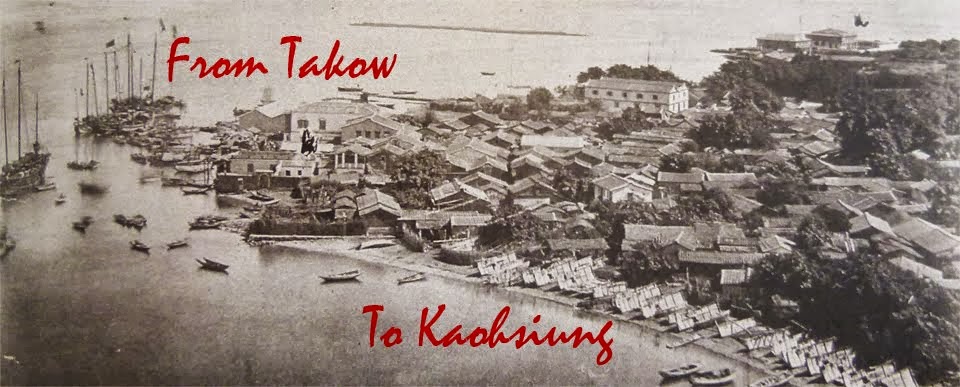
Originally called Takow River (打狗川; possibly a refence to the Makatau plains aborigines or to a Siraya aboriginal word for “bamboo forest”; see Kaohsiung), this was changed during the Period of Japanese Rule to 高雄川 (Jpn. Takaogawa; lit. "Lofty Hero River"), which was preserved by the incoming KMT-led ROC administration in 1945, albeit using the Mandarin pronunciation Gaoxiong Chuan, and romanized as “Kaohsiung Chuan”.
 > ...................(photo Wikipedia)
Its transformation to the romantic “Love River” is said to date from two events early in the postwar period. Firstly a typhoon damaged the advertising board of the “Love River Cruise" (愛河遊船所) leaving just the two characters 愛河. Secondly, a local journalist went to cover the suicide of a young couple who had drowned in the river and illustrated his report with a photograph of the damaged sign.
The river soon gained a new nickname, which was later adopted as its official name, and which survived attempts (perhaps by Kaohsiung’s mayor, perhaps by first lady Soong Mei-ling, 宋美齡) to add the character 仁 (Mdn. ren; “benevolence”), thus making it the Ren-ai River (“Benevolence & Love”; two of the Confucian “eight virtues” 八德, see Bade District, Taoyuan) to commemorate the birthday of President Chiang Kai-shek.
Copyright Jiyue Publications 2022
> ...................(photo Wikipedia)
Its transformation to the romantic “Love River” is said to date from two events early in the postwar period. Firstly a typhoon damaged the advertising board of the “Love River Cruise" (愛河遊船所) leaving just the two characters 愛河. Secondly, a local journalist went to cover the suicide of a young couple who had drowned in the river and illustrated his report with a photograph of the damaged sign.
The river soon gained a new nickname, which was later adopted as its official name, and which survived attempts (perhaps by Kaohsiung’s mayor, perhaps by first lady Soong Mei-ling, 宋美齡) to add the character 仁 (Mdn. ren; “benevolence”), thus making it the Ren-ai River (“Benevolence & Love”; two of the Confucian “eight virtues” 八德, see Bade District, Taoyuan) to commemorate the birthday of President Chiang Kai-shek.
Copyright Jiyue Publications 2022
Tuesday 18 January 2022
Xueshan (雪山; 3,886m), Heping District, Taichung
At first sight, Xueshan (雪山), literally meaning “Snow(y) Mountain”, would seem to be named for its appearance since, in winter at least, its higher sections are indeed snow-capped.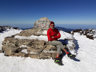 > ......................... On the summit of Xueshan in winter (photo copyright JYP)
As so often with Taiwan’s toponymy, however, things may not be so straight-forward. For the Atayal (泰雅) aborigines, to whose traditional hunting grounds this area belonged, it was known as:
i) B'bu' Hagay meaning “Stone Mountain” for the sandstone rocks poking through the snow;
ii) Mahamayan, which sometimes appeared in Chinese texts transliterated as 馬哈馬顏山 (Mdn. Ma-ha-ma-yan Shan); or
> ......................... On the summit of Xueshan in winter (photo copyright JYP)
As so often with Taiwan’s toponymy, however, things may not be so straight-forward. For the Atayal (泰雅) aborigines, to whose traditional hunting grounds this area belonged, it was known as:
i) B'bu' Hagay meaning “Stone Mountain” for the sandstone rocks poking through the snow;
ii) Mahamayan, which sometimes appeared in Chinese texts transliterated as 馬哈馬顏山 (Mdn. Ma-ha-ma-yan Shan); or
iii) Sekoan, meaning “gravel and cracks”. It is this last that may well be the origin of today’s name, since another early Chinese name for the mountain was 雪翁山, meaning “Snow(y) Old-Man Mountain” ( or 雪高翁山; “Snow(y) High Old-Man Mountain”). Pronounced something like Seh-ang-soaⁿ in Hoklo Taiwanese, it is suggested as a possible transliteration of the Atayal Sekoan. [MC: Since Hoklo words pronouned "sek" would be available, perhaps it might be considered a "rough transliteration using characters with suitable meanings".] > ........................ Xuashan's main peak (photo Peellden, Wikipedia commons)
Confusingly, in some early texts it was also called 玉山 (Mdn. Yushan; “Jade Mountain”). Yushan was eventually chosen as the name of Taiwan’s highest mountain, located on the border of Nantou County's Xinyi Township, Kaohsiung City's Taoyuan District, and Chiayi County's Alishan Township.
In 19th-century English-langauge texts it appeared as “Mt. Sylvia”, named by the captain of the British gunboat “Sylvia” who spotted the mountain when sailing through the Taiwan Strait in 1867.
As Taiwan’s 2nd highest mountain at 3,886m above sea level and, therefore, higher than Mt. Fuji (3,776), during the Period of Japanese Rule (1895~1945) it became known as Tsugitakayama (次高山; lit. “Next [i.e., 2nd] Highest Mountain”).
In the postwar period, President Chiang Kai-shek renamed it 興隆山 (Mdn. Xinglong Shan; lit. “Prosperity Mountain”) but, unlike so many of his namings, this one did not stick.
(main source: Wikipedia)
Copyright Jiyue Publications 2022
> ........................ Xuashan's main peak (photo Peellden, Wikipedia commons)
Confusingly, in some early texts it was also called 玉山 (Mdn. Yushan; “Jade Mountain”). Yushan was eventually chosen as the name of Taiwan’s highest mountain, located on the border of Nantou County's Xinyi Township, Kaohsiung City's Taoyuan District, and Chiayi County's Alishan Township.
In 19th-century English-langauge texts it appeared as “Mt. Sylvia”, named by the captain of the British gunboat “Sylvia” who spotted the mountain when sailing through the Taiwan Strait in 1867.
As Taiwan’s 2nd highest mountain at 3,886m above sea level and, therefore, higher than Mt. Fuji (3,776), during the Period of Japanese Rule (1895~1945) it became known as Tsugitakayama (次高山; lit. “Next [i.e., 2nd] Highest Mountain”).
In the postwar period, President Chiang Kai-shek renamed it 興隆山 (Mdn. Xinglong Shan; lit. “Prosperity Mountain”) but, unlike so many of his namings, this one did not stick.
(main source: Wikipedia)
Copyright Jiyue Publications 2022
At first sight, Xueshan (雪山), literally meaning “Snow(y) Mountain”, would seem to be named for its appearance since, in winter at least, its higher sections are indeed snow-capped.
iii) Sekoan, meaning “gravel and cracks”. It is this last that may well be the origin of today’s name, since another early Chinese name for the mountain was 雪翁山, meaning “Snow(y) Old-Man Mountain” ( or 雪高翁山; “Snow(y) High Old-Man Mountain”). Pronounced something like Seh-ang-soaⁿ in Hoklo Taiwanese, it is suggested as a possible transliteration of the Atayal Sekoan. [MC: Since Hoklo words pronouned "sek" would be available, perhaps it might be considered a "rough transliteration using characters with suitable meanings".]
Greater Taipei area MRT stations
[MC: very much a work in progress] (Organized by line)
Sanying Line (三鶯線; "San[xia &] Ying[ge] Line)
Dingpu (頂埔) Station
Literally "Top Plain". Mazutian (媽祖田) Station
Mazutian (媽祖田; lit. Mazu’s Field(s)) is named for the seafarers' deity Mazu (媽祖; lit. "Maternal Ancestor"). For details of the 10th-century historical figure, see Matsu Islands.
Wazi (挖子) Station (lit. "dig+noun suffix" [MC= [archaeological] "excavation"?]
Hengxi (橫溪) Station
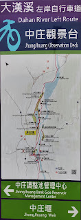
Located just outside central Sanxia, Hengxi (橫溪; lit. “Horizontal River”), at 10km, is the shortest of the “Three [River] Valleys” from which Sanxia was named; the other two being the Sanxia River (三峽河; 28.5km ) and Dahan River (大漢溪; 135km).
Longpu (龍埔) Station
Sanxia (National Academy for Educational Research) (三峽 - (國家教育研究院) Station
National Taipei University (En Chu Kong Hospital) (臺北大學 (恩主公醫院) Station
Yingge (鶯歌) Station
Connects with TRA station of same name, dating from 1901 Ceramics Old Street (陶瓷老街) Station
Guohua (國華) Station
Yongji Park (永吉公園; lit. “Auspicious Park”) Station
Yingtao Fude (鶯桃福德) Station
Located at the junction of Fude 1st Road and Yingtao Road (i.e., the road connecting Yingge with Taoyuan: see AB BA roads)
Shuxianpi (豎啣埤) Station
Da’nan (大湳) Station
Copyright Jiyue Publications 2022
[MC: very much a work in progress] (Organized by line)
Sanying Line (三鶯線; "San[xia &] Ying[ge] Line)
Dingpu (頂埔) Station
Literally "Top Plain". Mazutian (媽祖田) Station
Mazutian (媽祖田; lit. Mazu’s Field(s)) is named for the seafarers' deity Mazu (媽祖; lit. "Maternal Ancestor"). For details of the 10th-century historical figure, see Matsu Islands.
Wazi (挖子) Station (lit. "dig+noun suffix" [MC= [archaeological] "excavation"?]
Hengxi (橫溪) Station
Located just outside central Sanxia, Hengxi (橫溪; lit. “Horizontal River”), at 10km, is the shortest of the “Three [River] Valleys” from which Sanxia was named; the other two being the Sanxia River (三峽河; 28.5km ) and Dahan River (大漢溪; 135km).
Longpu (龍埔) Station
Sanxia (National Academy for Educational Research) (三峽 - (國家教育研究院) Station
National Taipei University (En Chu Kong Hospital) (臺北大學 (恩主公醫院) Station
Yingge (鶯歌) Station
Connects with TRA station of same name, dating from 1901 Ceramics Old Street (陶瓷老街) Station
Guohua (國華) Station
Yongji Park (永吉公園; lit. “Auspicious Park”) Station
Yingtao Fude (鶯桃福德) Station
Located at the junction of Fude 1st Road and Yingtao Road (i.e., the road connecting Yingge with Taoyuan: see AB BA roads)
Shuxianpi (豎啣埤) Station
Da’nan (大湳) Station
Copyright Jiyue Publications 2022
Monday 17 January 2022
Sanxia (三峽) Township, New Taipei City
Originally part of Atayal (泰雅) Aboriginal territory, the area now known as Sanxia (三峽; lit. "Three Gorges") was initially called 三角湧 (Mdn. Sanjiaoyong; Hoklo: Saⁿ-kak-eng; lit. "Three-Corner Surge") by immigrating Fujianese.
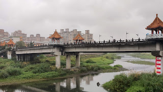 .................................... Sanxia River (on a dull afternoon)
 This name is said to refer to the confluence of the Dahan River (大漢溪), Sansia River (三峽河), and Heng River (橫溪; lit. "Horizontal River") [MC: today there is no single confluence, though this does not mean that there wasn't one several centuries ago], at which the river waters apparently "surged / rose up".
In 1920, the Japanese colonial administration, [MC: under its simplifiation of 3-character place names to two characters], changed 三角湧 (Jpn. Sankakuyū) to 三峽 (Jpn. Sankyō) after the three river valleys running through the township.
This name is said to refer to the confluence of the Dahan River (大漢溪), Sansia River (三峽河), and Heng River (橫溪; lit. "Horizontal River") [MC: today there is no single confluence, though this does not mean that there wasn't one several centuries ago], at which the river waters apparently "surged / rose up".
In 1920, the Japanese colonial administration, [MC: under its simplifiation of 3-character place names to two characters], changed 三角湧 (Jpn. Sankakuyū) to 三峽 (Jpn. Sankyō) after the three river valleys running through the township.
 > ...... Goose meat restaurant in Sanxia using the town's old name of Sanjiaoyong (三角湧)
Copyright Jiyue Publications 2022
> ...... Goose meat restaurant in Sanxia using the town's old name of Sanjiaoyong (三角湧)
Copyright Jiyue Publications 2022
Dahan River (大漢溪) , Northwestern Taiwan
 The Dahan River (大漢溪; [MC: perhaps named after the Han dynasty, Han River in China, or Han ethnicity, that is, Han-Chinese poeple]) originates in the Xueshan mountain range and runs for 135km through Hsinchu County, Taoyuan City and New Taipei City, before joining the Xindian River in Taipei to form the Tamshui River.
Since the late 1950s, the Dahan River has been dammed in Taoyuan's Fuxing (復興) District near Daxi (大溪) forming the Shimen Reservoir (石門水庫)
The Dahan River was previously known as 大嵙崁溪 (Takekan River), which is retained today for the upper reaches. Much earlier, it followed a more northerly route, entering the sea about 20 kilometres west of today's Tamsui River estuary, until tectonic movement around 30,000 years ago caused the Taipei Basin to drop in elevation, rerouting the Dahan River into the Tamsui River system [source here]
The Dahan River (大漢溪; [MC: perhaps named after the Han dynasty, Han River in China, or Han ethnicity, that is, Han-Chinese poeple]) originates in the Xueshan mountain range and runs for 135km through Hsinchu County, Taoyuan City and New Taipei City, before joining the Xindian River in Taipei to form the Tamshui River.
Since the late 1950s, the Dahan River has been dammed in Taoyuan's Fuxing (復興) District near Daxi (大溪) forming the Shimen Reservoir (石門水庫)
The Dahan River was previously known as 大嵙崁溪 (Takekan River), which is retained today for the upper reaches. Much earlier, it followed a more northerly route, entering the sea about 20 kilometres west of today's Tamsui River estuary, until tectonic movement around 30,000 years ago caused the Taipei Basin to drop in elevation, rerouting the Dahan River into the Tamsui River system [source here]
 This drawing of Japanese era Daxi (大溪) Township clearly marks the river at the top as Danshui River (Tamsui; 淡水河) suggesting:
i) this was its name at that time, or
ii) this is a mistake.
Copyright Jiyue Publications 2022
This drawing of Japanese era Daxi (大溪) Township clearly marks the river at the top as Danshui River (Tamsui; 淡水河) suggesting:
i) this was its name at that time, or
ii) this is a mistake.
Copyright Jiyue Publications 2022
Zhongheng (中正) District, Taipei City
Zhongzheng (中正; lit. "central uprightness") District was formed in 1990 by merging the old Chengzhong (城中; "City Center") District with Guting (古亭) District and some neighborhoods of Daan (大安) District.
 It is called either directly after former President Chiang Kai-shek (蔣介石; who took the name Chiang Chung-cheng; "Centrality [and] Uprightness" {蔣中正; HP: Jiang Zhong-zheng} in 1917/18), or indirectly after the National Chiang Kai-shek Memorial Hall (國立中正紀念堂), which lies within its boundary.
CKS explained his choice of name as referring to the Confucian expression 大中至正 (Mdn: da zhong zhi zheng; lit. “great centrality and perfect uprightness”), saying it was "a phrase that embodied the beliefs and principles by which he lived his life.”Cynics say he chose it to echo the name Zhongshan (中山; "Central Mountain"; see Zhongshan District etc.) adopted by his mentor and founder of the Chinese National Party, Sun Yat-sen.
Text and photo copyright Jiyue Publications 2022
It is called either directly after former President Chiang Kai-shek (蔣介石; who took the name Chiang Chung-cheng; "Centrality [and] Uprightness" {蔣中正; HP: Jiang Zhong-zheng} in 1917/18), or indirectly after the National Chiang Kai-shek Memorial Hall (國立中正紀念堂), which lies within its boundary.
CKS explained his choice of name as referring to the Confucian expression 大中至正 (Mdn: da zhong zhi zheng; lit. “great centrality and perfect uprightness”), saying it was "a phrase that embodied the beliefs and principles by which he lived his life.”Cynics say he chose it to echo the name Zhongshan (中山; "Central Mountain"; see Zhongshan District etc.) adopted by his mentor and founder of the Chinese National Party, Sun Yat-sen.
Text and photo copyright Jiyue Publications 2022
Sunday 16 January 2022
Daan (大安) District, Taipei City
Daan's (大安; "Great Peace / Tranquility /Seurity") toponymic history is a little obscure, which is perhaps surprising, since it is a relative newcomer, as the Taipei Basin was developed somewhat later than other areas along the west and northwest coasts.
Lying outside the original Taipei City, to the east and southeast of the short-lived, late-19th-century city walls, this was still farmland at the time to which its name can be traced, and which seems to be connected to the irrigation channels that brought river waters here. These are known in Hoklo Taiwanese as chun (圳).
[MC: The fact that a) the character is not even in the Far East Chinese-English Dictionary; b) has a different pronunciation in Taiwan's Mandarin, zun, from PRC Mandarin's zhen; and c) certainly exists in Cantonese given the existence of the Special Economic Zone of Shenzhen (深圳) in the PRC's Guangdong Province; together suggest it is an old character, retained in southern regionalects of Fujian, Taiwan and Guangdong, but perhaps not in more recent, northern regionalects, such as Beijingese and its close relative, Mandarin.].
Various theories as to the origin of the district's name exist, though none seems definitive. These include:
i) The irrigaation channel serving this neighborhood was simply called 大安圳 ("Great Peace Irrigation").
ii) The irrigation channel took a sharp turn or had a half-moon-shaped storage pool (in the area of today's Ren-ai Circle-Anhe Rd-Yanji Rd area), giving rise to the name 大灣 (Mdn. Dawan, in which wan, as well as being a "bay", also indicates a "bend in a river" or, in this case, in an irrigation channel), and which was later changed to the similar-sounding but more elegant Daan.
iii) Many of the immigrants to this area came from Anxi (安溪) area in Fujian's Quanzhou prefecture, giving rise to the nickname that this was the new home of the "Great Anxi" (偉大安溪) poeple.
[iv) MC: is there a possibility that "Daan" reflects an earlier Aboriginal name? The -an ending is said to be common in Austronesian place names, indicating "place".]
In both the late-Period of Japanese Rule and postwar ROC administrative era, several smaller units, including Daan Village, were combined together under the name of Daan to become a district of Taipei City.
Copyright Jiyue Publications 2022
On Tribe and Ethnic Group
Languages change over time, words that meant one thing decades or centuries ago can evolve, not just in spelling and pronunciation, but also in meaning. Sometimes, like "silly" (which originally meant "happy") or "nice" (which meant "silly", as in "not knowing"), they end up meaning something completely different.
During the period in which words are undergoing such changes, people can become indignant or even irate about other people's errors or stupidity, such as at the present time with words such as "literally" or "ironic" or "coincidental". Maybe these words will also end up with new meanings.
On other occasions, this kind of variation in word usage just causes confusion until things settle down. One word that is perhaps also undergoing evolution in our own times and which is of relevance to this blog is "tribe". Within anthropology, this may be defined as "a society larger than a band but smaller than a state" (see Wiktionary), though even that isn't particularly specific. Elsewhere, it is used to refer to whole "ethnic groups or races of people".
 Within the context of Taiwan's indigenous peoples--who self-identify as "Aborigines" (原住民; Mdn. Yuanzhumin)--"tribe" is generally used to translate 部落 (Mdn. buluo), that is, a village, while "ethnic group" is used to translate 族 (Mdn. zu), generally subdivided on the basis of language and other cultural traits.
This blog accords with these usages.
Copyright Jiyue Publications 2022
Within the context of Taiwan's indigenous peoples--who self-identify as "Aborigines" (原住民; Mdn. Yuanzhumin)--"tribe" is generally used to translate 部落 (Mdn. buluo), that is, a village, while "ethnic group" is used to translate 族 (Mdn. zu), generally subdivided on the basis of language and other cultural traits.
This blog accords with these usages.
Copyright Jiyue Publications 2022
List of all posts Alphabetically by County / City
Taiwan (臺灣 / 台灣)
Ilha Formosa
 Taipei City
Beitou (北投) District
......... Yangming Mountain (陽明山)
Daan (大安) District
......... Guting (古亭)
Nangang (南港路) District
Shilin (士林) District
Songshan (松山) District
Wanhua (萬華) District
........ Ximending (西門町)
Wenshan (文山) District
........... Muzha (木柵)
Xinyi (信義) District
Zhongzheng (中正) District
......... Gongguan (公館)
Taipei City
Beitou (北投) District
......... Yangming Mountain (陽明山)
Daan (大安) District
......... Guting (古亭)
Nangang (南港路) District
Shilin (士林) District
Songshan (松山) District
Wanhua (萬華) District
........ Ximending (西門町)
Wenshan (文山) District
........... Muzha (木柵)
Xinyi (信義) District
Zhongzheng (中正) District
......... Gongguan (公館)
 Bade Road (八德路)
 Beiping Road (北平路), Taipei & Taichung
"Why Dunhua Road (敦化) is so wide"
Heping Road (和平路)
Jungong Road (軍功路)
Ren-ai Road (仁愛路)
Shuangshi Raod (雙十路), Taichung City and Banqiao District, New Taipei City
Siwei Road (四維路)
Tingzhou Road (汀州路)
Xikou Street (溪口街)
Xinhai Road (辛亥路), Taipei City
Xinsheng Road (新生路)
Xinyi Road (信義路)
Yixian Road (逸仙路), Taipei
Zhongxiao Road (忠孝路)
Greater Taipei area MRT stations
台北 vs. 臺北 (and here)
Bannan Line (板南線; a.k.a. Blue Line)
Sanying Line (三鶯線; a.k.a. Light Blue Line)
Wenhu Line (文湖線; a.k.a. Brown Line)
Beiping Road (北平路), Taipei & Taichung
"Why Dunhua Road (敦化) is so wide"
Heping Road (和平路)
Jungong Road (軍功路)
Ren-ai Road (仁愛路)
Shuangshi Raod (雙十路), Taichung City and Banqiao District, New Taipei City
Siwei Road (四維路)
Tingzhou Road (汀州路)
Xikou Street (溪口街)
Xinhai Road (辛亥路), Taipei City
Xinsheng Road (新生路)
Xinyi Road (信義路)
Yixian Road (逸仙路), Taipei
Zhongxiao Road (忠孝路)
Greater Taipei area MRT stations
台北 vs. 臺北 (and here)
Bannan Line (板南線; a.k.a. Blue Line)
Sanying Line (三鶯線; a.k.a. Light Blue Line)
Wenhu Line (文湖線; a.k.a. Brown Line)
 New Taipei City
Bali (八里) District
......... Dabenkeng (大坌坑) site / prehistoric culture
Banqiao (板橋) District
Gongliao (貢寮) District
Sandiaojiao (三貂角) District
...,,,,,, Sandiaoling Station (三貂嶺車站)
Luzhou (蘆洲) District
Sanchong (三重) District
Sanxia (三峽) District
Shimen (石門) District
......... Fugui (富貴) Cape
Shuangxi (雙溪) District
Tucheng (土城) District
Wanli (萬里) District
......... Yeliu (野柳) Harbor
Wugu (五股) District
New Taipei City
Bali (八里) District
......... Dabenkeng (大坌坑) site / prehistoric culture
Banqiao (板橋) District
Gongliao (貢寮) District
Sandiaojiao (三貂角) District
...,,,,,, Sandiaoling Station (三貂嶺車站)
Luzhou (蘆洲) District
Sanchong (三重) District
Sanxia (三峽) District
Shimen (石門) District
......... Fugui (富貴) Cape
Shuangxi (雙溪) District
Tucheng (土城) District
Wanli (萬里) District
......... Yeliu (野柳) Harbor
Wugu (五股) District
 Wulai (烏來) District
Xizhi (汐止) District
......... Wudu Railway Station (五堵車站)
Xindian (新店)
......... Ankeng (安坑)
........ Bitan (碧潭)
........ Dapinglin (大坪林) MRT Station
Keelung City
Ren-ai (仁愛) District
Taoyuan City
Bade (八德) District
Guanyin (觀音) District
Hsinchu County
......... Dahan River (大漢溪)
Guanxi (關西) Township
Jianshi (尖石) Township
Qionglin (芎林) Township
Xinpu (新埔) Township
Zhubei (竹北) City
Miaoli (苗栗) County
Gongguan (公館) Township
......... Qiugou (邱苟)
Houlong (後龍) Township
Tongxiao (通霄) Township
Yuanli (苑裡) Township
Zhuolan (卓蘭) Township
Taichung City
Wufeng (霧峰) District
Wuri (烏日) District
Nantou County
Caotun (草屯) Township
Guoxing (國姓) Township
Ren-ai (仁愛) Township
Xinyi (信義) Township
........ Yushan (玉山; “Jade Mountain”)
Yuchi (魚池) Township
........ Sun Moon Lake (日月潭)
Zhushan (竹山) Township
Wulai (烏來) District
Xizhi (汐止) District
......... Wudu Railway Station (五堵車站)
Xindian (新店)
......... Ankeng (安坑)
........ Bitan (碧潭)
........ Dapinglin (大坪林) MRT Station
Keelung City
Ren-ai (仁愛) District
Taoyuan City
Bade (八德) District
Guanyin (觀音) District
Hsinchu County
......... Dahan River (大漢溪)
Guanxi (關西) Township
Jianshi (尖石) Township
Qionglin (芎林) Township
Xinpu (新埔) Township
Zhubei (竹北) City
Miaoli (苗栗) County
Gongguan (公館) Township
......... Qiugou (邱苟)
Houlong (後龍) Township
Tongxiao (通霄) Township
Yuanli (苑裡) Township
Zhuolan (卓蘭) Township
Taichung City
Wufeng (霧峰) District
Wuri (烏日) District
Nantou County
Caotun (草屯) Township
Guoxing (國姓) Township
Ren-ai (仁愛) Township
Xinyi (信義) Township
........ Yushan (玉山; “Jade Mountain”)
Yuchi (魚池) Township
........ Sun Moon Lake (日月潭)
Zhushan (竹山) Township Yunlin County (雲林)
Beigang (北港) Township
Vasikan (貓兒干) archaeological culture
Yunlin County (雲林)
Beigang (北港) Township
Vasikan (貓兒干) archaeological culture
 Chiayi (嘉義) County
Alishan (阿里山) Township
Budai (布袋) Township
Dalin (大林) Township
Dongshi (東石) Township
Fanlu (番路) Township
Liujiao (六腳) Township
Minxiong (民雄) Township
Xikou (溪口) Township
Yizhu (義竹) District
Zengwen River (曾文溪) & Reservoir (曾文水庫)
Tainan City
Jiali (佳里) District
Madou (麻豆) District
Qigu (七股) District
Shanhua (善化) District
Xinshi (新市) District
Yujing (玉井) District
Luermen (鹿耳門)
Kaohsiung City
Neimen (內門) District
Namasiya (那瑪夏) District
Sanmin (三民) District
Chiayi (嘉義) County
Alishan (阿里山) Township
Budai (布袋) Township
Dalin (大林) Township
Dongshi (東石) Township
Fanlu (番路) Township
Liujiao (六腳) Township
Minxiong (民雄) Township
Xikou (溪口) Township
Yizhu (義竹) District
Zengwen River (曾文溪) & Reservoir (曾文水庫)
Tainan City
Jiali (佳里) District
Madou (麻豆) District
Qigu (七股) District
Shanhua (善化) District
Xinshi (新市) District
Yujing (玉井) District
Luermen (鹿耳門)
Kaohsiung City
Neimen (內門) District
Namasiya (那瑪夏) District
Sanmin (三民) District
 Pingtung County
Checheng (車城) Township
Donggang (東港) Township
......... Gaoping River (高屏溪)
Hengchun (恆春) Township
Mudan (牡丹) Township
Sandimen (三地門) Township
Hualien
Ji-an (吉安) Township
Taroko / Truku (太魯閣)
Xincheng (新城鄉) Township
Yilan County
Lanyang River (蘭陽溪) Toucheng (頭城) Township
......... Shicheng Station (石城車站)
Zhuangwei (壯圍) Township
Jiang Wei-shui Yilan-Taipei Freeway (蔣渭水高速公路)
Penghu County
Xiyu (西嶼) Township
Fujian (福建) Province
Kinmen (金門)
Lieyu (烈嶼) Township, Kinmen
Matsu Islands (馬祖), Lienchiang County
Juguang (莒光) Township
Taiwan Railways Administration (TRA) Stations
Sandiaoling Station (三貂嶺車站)
Shicheng Station (石城車站)
Wudu Railway Station (五堵車站)
High Speed Rail (HSR) Stations
01 Nangang HSR Station (南港) Nangang District, Taipei City
02 Taipei HSR Station (臺北) Zhongzheng District, Taipei City
03 Banqiao HSR Station (板橋) Banqiao District, New Taipei City
04 Taoyuan HSR Station (桃園) Zhongli District, Taoyuan City
05 Hsinchu HSR Station (新竹) Zhubei City, Hsinchu County
06 Miaoli HSR Station (苗栗) Houlong Township, Miaoli County
07 Taichung HSR Station (台中) Wuri District, Taichung City
08 Changhua HSR Station (彰化) Tianzhong Township, Changhua County
09 Yunlin HSR Station (雲林) Huwei Townhship, Yunlin County
10 Chiayi HSR Station (嘉義) Taibao City, Chiayi County
11 Tainan HSR Station (台南) Gueiren District, Tainan City
12 Zuoying HSR Station (左營) Zuoying District, Kaohsiung City
Highest (& otherwise interesting) Mountains
Pingtung County
Checheng (車城) Township
Donggang (東港) Township
......... Gaoping River (高屏溪)
Hengchun (恆春) Township
Mudan (牡丹) Township
Sandimen (三地門) Township
Hualien
Ji-an (吉安) Township
Taroko / Truku (太魯閣)
Xincheng (新城鄉) Township
Yilan County
Lanyang River (蘭陽溪) Toucheng (頭城) Township
......... Shicheng Station (石城車站)
Zhuangwei (壯圍) Township
Jiang Wei-shui Yilan-Taipei Freeway (蔣渭水高速公路)
Penghu County
Xiyu (西嶼) Township
Fujian (福建) Province
Kinmen (金門)
Lieyu (烈嶼) Township, Kinmen
Matsu Islands (馬祖), Lienchiang County
Juguang (莒光) Township
Taiwan Railways Administration (TRA) Stations
Sandiaoling Station (三貂嶺車站)
Shicheng Station (石城車站)
Wudu Railway Station (五堵車站)
High Speed Rail (HSR) Stations
01 Nangang HSR Station (南港) Nangang District, Taipei City
02 Taipei HSR Station (臺北) Zhongzheng District, Taipei City
03 Banqiao HSR Station (板橋) Banqiao District, New Taipei City
04 Taoyuan HSR Station (桃園) Zhongli District, Taoyuan City
05 Hsinchu HSR Station (新竹) Zhubei City, Hsinchu County
06 Miaoli HSR Station (苗栗) Houlong Township, Miaoli County
07 Taichung HSR Station (台中) Wuri District, Taichung City
08 Changhua HSR Station (彰化) Tianzhong Township, Changhua County
09 Yunlin HSR Station (雲林) Huwei Townhship, Yunlin County
10 Chiayi HSR Station (嘉義) Taibao City, Chiayi County
11 Tainan HSR Station (台南) Gueiren District, Tainan City
12 Zuoying HSR Station (左營) Zuoying District, Kaohsiung City
Highest (& otherwise interesting) Mountains
 Xiuguluan Mountain (秀姑巒山; 3,825m), Hualien County
Xueshan (雪山)
Yangming Mountain (陽明山)
Yushan (玉山; “Jade Mountain”)
Xiuguluan Mountain (秀姑巒山; 3,825m), Hualien County
Xueshan (雪山)
Yangming Mountain (陽明山)
Yushan (玉山; “Jade Mountain”)
 Major Rivers
Dahan River (大漢溪)
Gaoping River (高屏溪)
Lanyang River (蘭陽溪)
Love River (愛河), Kaohsiung City
Qishan River (旗山溪)
Tamsui River (淡水河), Taipei City / New Taipei City
Xiuguluan River (秀姑巒溪), Hualien
Zengwen River (曾文溪)
Miscellaneous Extras
AB BA roads
Administrative units during Period of Japanese Rule (1895~1945)
Miscellany of 19th-century Notes on 17th-century Dutch Historical Records
Major Rivers
Dahan River (大漢溪)
Gaoping River (高屏溪)
Lanyang River (蘭陽溪)
Love River (愛河), Kaohsiung City
Qishan River (旗山溪)
Tamsui River (淡水河), Taipei City / New Taipei City
Xiuguluan River (秀姑巒溪), Hualien
Zengwen River (曾文溪)
Miscellaneous Extras
AB BA roads
Administrative units during Period of Japanese Rule (1895~1945)
Miscellany of 19th-century Notes on 17th-century Dutch Historical Records
 Deity Guan Gong (關公), (a.k.a. Guan Di (關帝), Guan Yu (關羽) &c.)
"Houses": Cuo (厝) vs. Wu (屋)
List of Taiwan's indigenous ethnic groups
Men (門; "Door / Gate ...")
Campaigns for the Rectification of Names
Romanizations: List of disused and unorthodox systems
San Min Zhuyi (三民主義; Three Principles of the People)
Townships: Rural 鄉 and Urban 鎮
On the Transliteration of Aboriginal place names
On "Tribe" and "Ethnic Group"
Wu (屋; “House”)
External links
Academic paper on postwar naming of Taipei City streets (and more)
Road sign names is election issue
Map of Taiwan 1901
Pre-1895 Japanese map of Taiwan
MC's Euroview article on translating place names
Deity Guan Gong (關公), (a.k.a. Guan Di (關帝), Guan Yu (關羽) &c.)
"Houses": Cuo (厝) vs. Wu (屋)
List of Taiwan's indigenous ethnic groups
Men (門; "Door / Gate ...")
Campaigns for the Rectification of Names
Romanizations: List of disused and unorthodox systems
San Min Zhuyi (三民主義; Three Principles of the People)
Townships: Rural 鄉 and Urban 鎮
On the Transliteration of Aboriginal place names
On "Tribe" and "Ethnic Group"
Wu (屋; “House”)
External links
Academic paper on postwar naming of Taipei City streets (and more)
Road sign names is election issue
Map of Taiwan 1901
Pre-1895 Japanese map of Taiwan
MC's Euroview article on translating place names

Subscribe to:
Posts (Atom)