subtitle

-- Working draft for upcoming book by Mark Caltonhill, author of "Private Prayers and Public Parades - Exploring the religious life of Taipei" and other works.

Thursday 29 December 2011

野柳、萬里 Yeliu Village/Harbor and Wanli Township, New Taipei City

Yeliu (野柳; lit. “wild willows”). Most of the large number of tourists visiting the geopark on the spit of land at Yeliu in Wanli District, New Taipei City, will be unaware that its bizarrely shaped rocks might also be behind the village’s name, which on the surface means “wild willows”.

While some suggest it is
a) a transliteration of an Aboriginal place name,
also hypothesized (for example on New Taipei City website) is
b) the partial transliteration of European seafarers’ description of the site.
Dutch called it Duijvel Hoek and Spanish Punto Diablos, both meaning “Devil’s Cape”. Loss of the D and B from diablos is said by some of having led to 野柳 (Hoklo: la-liu).

[MC: this explanation seems as bizzare as the rocks' shapes and needs further checking]

Wanli (萬里; lit. "myriad neighbourhoods") is located between Jinshan and Keelung, it was sometimes part of Jinshan (Jinbaoli; 金包里) sometimes of Keelung. In 1950 it was transfered from Keelung City administration to become a township in Taipei County (now New Taipei City).

Wanli is a shortened form of 萬里加投 (Hoklo: ban-li-ka-tau), possibly an earlier Aboriginal name or a transliteration of the Spanish name Barien for this area. The NTC source says Wanli Harbor was originally called 瑪鍊 (Hoklo: be-lien; lit. "agate smelt/chain") [This also requires further checking.]


Text and photos copyright Jiyue Publications
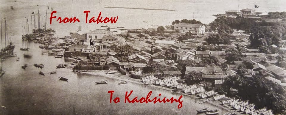
Monday 26 December 2011

Feature: Japanese map of Taiwan

Interesting map (apologies for awful photogrtaph) of Taiwan in/by Japanese but before their acquisition of the islands in 1895.

Not surprisingly, the southern Hengchun (恆春) penninsula is shown in additional detail, presumably showing their special knownledge of that region following Japan's invasion in 1874 (for more see "Hengchun" entry).

The map is on display at the National History Museum in Taipei

Sunday 18 December 2011

陽明山Yangmingshan Mountain/National Park, Taipei City

Yangmingshan (陽明山; lit. “sunny bright mountain”) was formerly a part of a larger group of hills known collectively as 草山 (Mdn. cao shan; lit. “grass mountain”), which included today’s Datunshan (大屯山), Qixingtan (七星山), Shaomaoshan (紗帽山) and Xiaoguanyinshan (小觀音山).

One explanation for the name “Grass Mountain” is that Qing-dynasty authorities, concerned about thieves hiding among trees and illegally extracting sulphur from the area, regularly set fire to the area’s botanical cover. Grasses best survive fire because they grow from the leaf-base (not tip like other plants) and also are quick to colonize cleared land. These hills became characterized by grasses, therefore, and in particular Miscanthus floridulus.

Yangming Mtn.’s highest peak is 七星山 (Mdn. Qi Xing Shan; lit. “seven star mountain”) at 1,120 metres, while Datunshan (大屯山, lit “big garrison mountain”), part of the earlier Grass Mountain group, rises to 1,093 metres.

In 1950, ROC President Chiang Kai-shek (蔣介石) renamed the southern section as 陽明山 (Mdn.: Yangmingshan), in honour of Ming-dynasty philosopher 王陽明 (Wang Yang-ming). The present national park dates from 1962.


President Chiang Kai-shek (1887-1975) is best known to the English-speaking world by the Cantonese pronunciation of his style name 蔣介石 (Mdn. Jiang Jie-shi), whereas most Taiwanese citizens know him by his self-chosen name of 蔣中正 (Mdn. Jiang Zhong-zheng), though those who worship him as a deity call him 蔣公 (“Duke Jiang”; see photo right: from a small temple in Danshui).

On information boards at the Chiang Kai-shek Memorial Hall (see photo left), Chiang’s selection of the name (名) Zhong-zheng (中正; lit. “centrality [and] uprightness”) from ca. 1917/18 onwards (see also Zhongzheng District, Taipei City) is formally explained as referring to the Confucian expression 大中至正 (Mdn.: Da Zhong Zhi Zheng; lit. “great centrality and perfect uprightness”): “This phrase embodies the beliefs and principles by which he lived his life.”

“This accolade … was applied to Wang Yang-ming, a great philosopher in the Ming Dynasty: … ‘Through constant and discriminating inner-reflection in the face of adversity, his achievement of moral self-cultivation has reached that of the great sages.’”

“President Chiang in lecturing about the teaching of The Doctrine of the Mean made the following comments: zhong is the correct course to be pursued by all under Heaven. The ideal of zhong includes six key points:
—possessing the great centrality and the perfect uprightness;
—standing firmly in the middle without inclining to either side;
—persisting without being moved by any circumstances;
—being cautious and mindful in order to achieve sagehood;
—adhering to goodness; and
—holding fast to the middle way.


Text and photos copyright Jiyue Publications 2011

Monday 12 December 2011

吉安鄉 Ji’an Township, Hualien County

Ji’an (吉安; lit. “auspicious peace”) Township was originally the Amis (阿美) Aboriginal community of Cikasuan. This was transliterated into Chinese as 七腳川 (Hoklo: Chhit-ka-chhoan; lit. “seven legs river”).

The Japanese established a village here called 吉野 (Jpn.: Yoshino; Mdn.: Jiye; lit. “auspicious wild”). After retrocession in 1945, this name was considered too Japanese-sounding, so the second character was changed in 1948, giving today’s 吉安 (Ji’an).


Text and photos © Jiyue Publications

蘭陽溪Lanyang River/Plain, Yilan County

Lanyang (蘭陽; lit. “orchid sun”) River flows west-to-east 73 km across the Lanyang Plain (蘭陽平原). It was formerly known as 濁水溪 (Mdn.: Zhuoshuixi ; lit. “muddy water river”).

The 蘭 (lan; "orchid") part of the name derives from Kavalan (transliterated into Chinese as 噶瑪蘭), the local Aboriginal ethnic group. (For more on this see Yilan and Kavalan.)


Text and photos © Jiyue Publications

壯圍鄉 Zhuangwei Township, Yilan County

[Explanations of place name origins are quite the vogue. The photo shows a board outside the township office in Zhuangwei, with a history of the town’s name in both i) Chinese and ii) English. Bizarrely, the two accounts are substantially different.

i) [translated] In earlier times, Wu Sha (吳沙) led men to clear land for cultivation. Later, to express his gratitude to and reward the strong people [壯民] for their efforts, he divided the land and gave [part] to them, for which it is called 民壯圍 (lit. “people strong surround”).

ii) [original] Minzhuangwei was the old name of Zhuangwei Township. Looking into the history of this town it was in the early days inhabited mainly by Pingpu Tribes. In 1802, Wu Hua (Wu Sha’s nephew) sent his follower Chen Meng Li to open and clear this area.

Abe and Tsai et al. (as well as Wikipedia’s Chinese-language entry) broadly accord with the former; but Wu Sha died in 1798 (as Wikipedia notes elsewhere) before Han Chinese settled this part of Yilan, and it was indeed nephew Wu Hua who rewarded the “strong people for their efforts”.]

Zhuangwei (壯圍; lit. “strong encirclement”) Township was formally called 民壯圍 (Mdn. minzhuangwei; lit. “people strong encirclement”): a 城圍 “walled encirclement” named in honor of the 壯民 (Mdn.: zhuang min; “strong people”) who accompanied Wu Sha (吳沙) to settle today’s Yilan in 1796 (for more details see Toucheng). Minzhuangwei was established in 1802 by Wu’s nephew Wu Hua (吳化) following his uncle’s death in 1798.

This “city wall” was a 土圍 (Mdn: tu-wei; earthen dyke) perhaps reinforced with a bamboo fence.

民 (Mdn.: min; “people”) was dropped in 1920 under Japanese rule.


Chuangwei (壯圍) alternative romanisation for Zhuangwei.
Jhuangwei (壯圍) alternative romanisation for Zhuangwei.


Text and photos © Jiyue Publications

蔣渭水高速公路 Jiang Wei-shui Freeway, Yilan-Taipei


Jiang Wei-shui Freeway (蔣渭水高速公路), is another name for the No.5 Freeway connecting Yilan and Taipei.

It is named after Yilan native Jiang Wei-shui (蔣渭水; 1891-1931), a medical doctor and political activist during the period of Japanese rule (1895-1945). Jiang helped found the Taiwan Cultural Association (台灣文化協會) and Taiwan People’s Party (台灣民眾黨) and was imprisoned frequently during the 1920s for his opposition to the colonial government.

Taipei City has a Weishui Road (渭水路) in Zhongshan District, a Chiang Wei-shui Memorial Park (蔣渭水紀念公園) on Jinxi Street (錦西街), and his burial site near Liuzhangli (see photo). Yilan City and Jiaoxi Township also have Weishui Roads.


In 2010, 50 million NT$10 coins commemorating Chiang were issued.


Text and photos © Jiyue Publications

Sunday 11 December 2011

頭城鎮 Toucheng Township, Yilan County

Toucheng (頭城; lit. “head city”) was the “head” (頭; i.e. first) base established by Han Chinese after arriving to colonize the Lanyang (蘭陽) Plain.

In 1796, Wu Sha (吳沙; 1731-98), a native of Fujian’s Zhangzhou Prefecture who immigrated to northern Taiwan in 1773, led more than 1,000 people from Zhangzhou, Quanzhou and Guandong, arriving at today’s Wushi Port (烏石港). To withstand attacks by local Kavalan (噶瑪蘭) Aborigines, they first built a defensive enclosure (圍; wei) of earth and bamboo. From this derived the name頭圍 (Touwei; lit. “first encirclement”), which was later changed to頭城 (Toucheng; 城 means originally a wall, and hence the city within its encircling wall; see Tucheng).

Trouble between the Aborigines and Chinese eased from 1797 onwards after Wu provided medical assistance to indigenous people following an outbreak of smallpox. Of course it is more than likely the immigrants brought the disease, indeed some historians claim the epidemic was started intentionally. The Kavalan then agreed to partition of the land into tribal and Han areas.

Wu died the following year and settlement of Yilan was continued by his nephew Wu Hua (吳化), resulting in five wei (圍; settlements with 城圍 “walled encirclements”) and ten jie (結; communities composed of ten 佃 tenant farmers). Both words are common in Yilan place names today, including the townships Zhuangwei (壯圍) and Wujie (五結).

Jie (結; Hoklo: xx) common in Yilan place names, historically composed of ten 佃 (Mdn: dian; tenant farmers). c.f. wei (圍; settlements with 城圍 “walled encirclements”)

Wei (圍; settlements with 城圍 “walled encirclements”), common in Yilan place names.

Wushi (烏石; lit. “crow/black stone”) Port is named after black rocks near the harbour entrance. This was the arrival point in 1796 for the first Han colonizers of today’s Yilan County.


Text and photos © Jiyue Publications

Thursday 8 December 2011

News Brief: Oh no there isn't

... but 3 months later ...

To show respect for the registered trademark name of Taipei 101 called "台北101" in Chinese and to be consistent with Taipei Arena's Chinese name “台北小巨蛋”, the traditional Chinese character "臺" has been substituted by the simplified Chinese character "台" on the Songshan line's Taipei Arena Station "台北小巨蛋" and the Xinyi line's Taipei 101/World Trade Center Station "台北101/世貿站".

The Taipei City Government's Department of Rapid Transport Systems (DORTS) reported on its website at the end of November.

News Brief: One Country Two System: MRT station names use two versions of the character “Tai” (臺 and 台)

At the end of July, the Taipei Rapid Transit Corporation (台北捷運公司; TRTC) changed the names of four stations on the Songshan and Xinyi lines, the Liberty Times reported in August (full Chinese-language article here).

These included two stations not yet in operation, Taipei 101 (臺北一0一) and Taipei Arena (臺北小巨蛋). By using 臺, they differ from those stations already in operation, which use the simpler version of the character, 台, in names such as Taipei Main Station (台北車站), NTU Hospital (台大醫院) and Taipower Building (台電大樓).

Furthermore, the paper argued, the [former “world tallest”] Taipei 101 building uses the simpler version in its official name, 台北一0一. So the Taipei City Government’s Department of Rapid Transport Systems (捷運局; DORTS), which is responsible for setting names, is neither following precedent nor respecting names already in use.

A spokesperson for Taipei 101 said the company is officially registered as 台北一0一, and uses 台 not 臺 on its signs and publications, so naturally it hopes the naming of the MRT station will accord with the formal name. But if the DORTS insists on using 臺, the company said it would have to respect that.

DORTS said it was taking in to consideration recent government promotion of the use of traditional characters, and so station names would thus use 臺. However, changing the simple character to traditional version in the existing names (Taipei Main Station &c.) would lead to confusion as they had been in use for many years, and the expense would be enormous, so they will not be changed.


Translation copyright Jiyue Publications

七股區 Qigu District, Tainan

Qigu (七股; lit. “seven stocks/shares”) District takes its name from seven investors behind the clearance of land for cultivation and building of huts (寮; Hoklo: liau) here. Consequently named 七股寮仔 (Hoklo: chit-ko-liau-a; “seven shares huts [+ noun suffix]”).

In 1920 under Japanese rule, 寮 (“huts”) was swapped for 庄 (Japanese: ショウ shou; “village”), and after retrocession in 1945, it became a township and now a district, without further change of name.

Earlier a salt-producing area, the lagoon at the estuary of the Zengwen River (曾文溪) is now a conservation area for the black-faced spoonbill (黑面琵鷺).

Cigu (七股) alternative romanisation of Qigu.

Chiku (七股) alternative romanisation of Qigu.


Text and photos copyright Jiyue Publications

玉井區 Yujing District, Tainan

[Some other districts of Tainan through which the Zengwen River runs include the following]


Yujing (玉井; lit. “jade well”) Township was formally called 大武壟 (Hoklo: dwa-bu-leng; lit. “large military ridge-in-paddy”), was originally the Siraya (西拉雅) Plains Aborigine [other sources say Tsou (鄒) Aborigine] Tapani (噍吧哖) community. Abe suggests that 17th-century Dutch references to "Dobale" and "Daubali" could refer to here.

In 1915, ex-policeman Yu Qing-fang (余清芳) led Han Chinese and Aborigines in an uprising against Japanese rule known to historians as the Tapani Incident (噍吧哖事件) or Xilai Temple Incident (西來庵事件). In this—as well as the subsequent Japanese military suppression, revenge on non-combatants, arrests and death sentences, and associated diseases and famines—more people (probably several thousand) died than in any other anti-Japanese incident.


In the revision of place names of 1920, the obscure characters 噍吧哖 (“tapani”; [no literal meaning, these characters are have only phonetic value])were changed in accordance with Japansee pronunciation to 玉井 (Japanese: tama-i). Pronounced yujing in Mandarin by the ROC administration, this name is used to the present day.

Yuching (玉井) alternative romanisation of Yujing.


Text and photos © Jiyue Publications 2011

Wednesday 7 December 2011

曾文溪、水庫 Zengwen River / Reservoir, Chiayi and Tainan

Zengwen (曾文; lit. “grt.grandparent culture”), the name of Taiwan’s fourth-longest river (138km; from Alishan Township in Chiayi County to the coast between Tainan's Qigu and Annan districts) and of its largest reservoir (17.14k㎡ when full), derives its name from 曾文 (Hoklo: chan-bun) Village.

This, in turn, took its name from a man with family name 曾 (Hoklo: Chan; Mdn. Zeng) and given name 文 (Hoklo: Bun; Mdn. Wen). Early in the Qing dynasty (清; 1683-1895), Mr. Chan Bun led settlers to clear land for cultivation in this area on the southern bank of the river in the northern suburbs of Shanhua Town. No trace of the village remains.

[2021 update: The river is named for one long-forgotten Zeng Wen (曾文). Abe only records him as having opened up land for cultivation here, but Wikipedia’s Chinese-language page says that he did so during the 17th-century Dutch period before going on to operate a ferry. Old Western maps call it the Soulang River, but sometimes the Zant River, which was perhaps a rendition of the Hoklo pronunciation Tsan of the surname 曾 (Mandarin: Zeng).]

Tsengwen (曾文) alternative romanisation of Zengwen.

Cengwun (曾文) alternative romanisation of Zengwen.

[Source: http://www.wcis.itri.org.tw/Upload/QUARTC/000114/31-14.pdf -- NEEDS VERIFICATION]

Text and photos © Jiyue Publications 2011, 2021

新市區, 善化區 Xinshi and Shanhua districts, Tainan

[Yesterday’s post mentioned that Saulang (sinicized as 蕭壠 Siauleng, today's 佳里 Jiali) was one of four main Siraya Plains Aboriginal communities, all in today’s Tainan. The other three were Mattau (荳社; today's 麻豆 Madou; see here), Sinckan (新港, today's 新市 Xinshi and Bakaloan (目加溜灣; today’s 善化 Shanhua).]

Xinshi (新市; lit. “new city/market”) was formerly 新港 (Hoklo: Sinkang; lit. “new port”). Due to the apparent descriptive nature of this name (Taiwan has had several "new ports", see Xingang), it is sometimes assumed to be original, but actually represents a sinicisation (transliteration) of Sinckan, the Sirayan (西拉雅) Plains Aboriginal name.

This was the first target of Dutch colonial (1624-61) "civilizing" and Christian proselytizing, so along with Favorlang further north, the Sirayan language--known as Sinckan--was the main means of communication between Aborigines and Ducth.

A Sinckan Gospel of St. Matthew was translated and many “Sinckan Manuscripts” (Sirayan/Chinese land contracts) are still in existence.

Due to its important location, under Zheng (鄭; 1662-83) and Qing (清; 1683-1895) rule the village grew into a thriving market town (市; Mdn.: shi), so became known as 新市仔 (Hoklo: sin-chhi-a; “new market”). In 1920 under Japanese rule, 新市 became the town’s official name.

Hsinshih (新市) alternative romanisation of Xinshi.

Sinshi (新市) alternative romanisation of Xinshi.

Xingang (新港; lit. "new port) refers to:
a) old name for Xinshi (新市) District, Tainan
b) Xingang Township, Chiayi County
c) [to be continued]

Shanhua (善化; lit. “better transform”) was formerly Bakaloan (目加溜灣), one of four main Sirayan (西拉雅) Plains Aboriginal communities prior to 17th-century foreign immigration.

Dutch colonists were attacked when collecting bamboo here in 1625, but ultimately subdued the area in 1635. Calling it Tevoran, they set up schools and churches, and encouraged Han Chinese immigration to grow rice and sugarcane.

Under Zheng-Ming rule (鄭, 1662-83), a military-farming community (屯田; see tun-tian) established here was called 善化 (Hoklo: sianhoa).


In the succeeding Qing dynasty (1683-1895), the area was called both 善化 but also 灣裡 (Hoklo: oanli; lit. “bay inside”), due to its location “within” a “bend” (similarly written and pronounced word: 彎; Hoklo: oan) in the Zengwen River (曾文溪).

Japanese re-organization of local government reverted to use of 善化 (Japanese: zenka), and 善化 (Mdn. shanhua) has continued in use under ROC rule since retrocession in 1945.


Text © Jiyue Publications 2011, 2021

佳里區 Jiali District, Tainan

Jiali (佳里; lit. “fine neighbourhood”) was, until the 20th century, known as 蕭壠 (Hoklo: Siauleng, lit. “reverent ridge-in-paddy”), a 17th-century transliteration of Siraya (西拉雅) Plains aboriginal Saulang—meaning “contracted land”—one of four major Siraya communities.

Under the 1920 Japanese colonial re-organisation of local government, the name Jiali (佳里) was adopted. This derived from another 17th-century name, 佳里興 (Mdn. Jialixing; lit. “fine neighbourhood prosper”), which, in roughly this area, was the administrative centre of 天興縣 (Mdn. Tianxing County; ) during Zheng family rule (鄭; 1662-83), and of 諸羅縣 (Mdn. Zhuluo County) under the succeeding Qing dynasty, until this was transferred to Zhuluo City (now Chiayi) at the beginning of the 18th century.

So why Japan’s name change from 蕭壠 to 佳里? Consistent Japanese practice (similar to Takow to Kaohsiung and many others) would suggest the use of different characters whose Japanese pronunciation matched the Hoklo Taiwanese pronunciation of the original, i.e. Siauleng. But 佳里 is pronounced kari in Japanese.

One possible explanation is the colonial authorities’ desire for a complete break from history, perhaps in light of the Siauleng Incident (蕭壟事件) of 1895 when up to 2,000 local people were massacred as a reprisal for armed resistance against the newly arriving colonizing army as it headed south towards Tainan.

Jiali citizens hold an annual ceremony to honour these antecedents, as well as a Burning of Lord Wang’s Boat (燒王爺船) event (hence the photo).


Text and photos © Jiyue Publications 2011

Tuesday 6 December 2011

coming soon

coming soon ... Zhushan (竹山; lit. "bamboo mountain") was formerly named after this man, who is now immortalized in a downtown temple.

[Ten years later this is done!: see here]

西嶼鄉 ( 漁翁嶼) Xiyu Township (Yuweng Isle) and the Pescadores, Penghu County

[If this seems a repetitive post, that is because it is three (five) separate entries in dictionary-style book]

Xiyu (西嶼; lit. “western isle”) Township constitutes an entire island (the most western of the main group and second-largest of all 64) in the 澎湖群島 (Penghu Archipelago). Home to many fishing and trading communities (e.g. 二崁 Erken, 外垵 Wai-an &c.), it is also known as 漁翁嶼/島 (Yuweng Yu/Dao; lit. “fishing man isle”), which has resonance with the Western name for Penghu: the Pescadores, which in Portuguese means “fishermen”.
Previous romanisations of Siyu and Hsiyu can still be seen.

Siyu (西嶼) alternative romanisation for Xiyu, Penghu County.

Hsiyu (西嶼) alternative romanisation for Xiyu, Penghu County.

Yuweng Yu/Dao (漁翁嶼/島; lit. “fishing man isle”) another name for Xiyu (西嶼; lit. “western isle”) Township, Penghu.
(See also: the Pescadores)

The Pescadores: Western name for 澎湖群島 (Penghu Archipelago), from Portuguese “fishermen”, also corresponding to 漁翁嶼 (Yuweng Yu; “fishing man isle”), an alternative name for 西嶼 (Xiyu; “western isle”), the archipelago’s second-largest island.
English-language accounts of Taiwan's history include two Pescadores Campaigns. The first in 1885 occurred at the end of the Sino-French War, when French forces occupied the islands to prevent Chinese re-arming of troops defending Keelung and Danshui.

The second in 1895 involved a similar assault by Japanese forces. Although it followed the armistice of the Sino-Japanese War, further fighting in Taiwan and Penghu was excluded by Japan so that it could strengthen its claim to take over the islands, which it did later that year.
Unlike “Formosa”, which also derives from Portuguese, “The Pescadeores" has no currency with average Taiwanese.


Text and photos © Jiyue Publications 2011

Monday 5 December 2011

大林鎮 Dalin Township, Chiayi County


Dalin (大林; lit. “large wood”) was earlier known as 大莆林 (dapulin; lit. “large water-weed wood”) or perhaps the similarly pronounced 大埔林 (dapulin; “large plains wood”), for which two explanations exist, neither of which is entirely satisfactory:

i) that prior to cultivation this area was covered by a large expanse of forest

ii) that early immigrants to this area in the Kangxi reign period (1661-1722) came from the woods of Dapu (大埔/莆) in Chaozhou Prefecture (潮州府), Guangdong Province.

莆 (pu; “water-weed”) was dropped during the Japanese local government re-organisation of 1920, giving today’s 大林 (Dalin; “big wood”).


Text and photos copyright Jiyue Publications

Saturday 3 December 2011

News Brief: place names is election issue

DPP candidate calls for checks of Hakka road sign names

Taipei Times, 23/09/2011
[link: http://www.taipeitimes.com/News/taiwan/archives/2011/09/23/2003513988]

Democratic Progressive Party legislative candidate Yiong Cong-ziin holds up examples in Miaoli County of Hakka place names where incorrect characters have been used, often significantly changing the meaning.
Photo: Peng Chien-li, Taipei Times

Yiong Cong-ziin (楊長鎮), director of the Democratic Progressive Party’s (DPP) Hakka affairs department, yesterday urged the government to conduct a thorough review of road signs for Hakka place names, saying they are often written using incorrect characters that significantly alter their meaning.

“Driving around Miaoli County, you will find road signs set up by either the county government or the Directorate-General of Highways using the wrong characters for these Hakka places,” Yiong said by telephone. “This shows the government’s lack of care and a disrespect for local culture.”

What’s more, these wrong signs often alter the original meaning of the names of those places, with this wrong information being passed on to visitors and the younger generation, he said.

“For example, the Xie’ai Ancient Trail (楔隘古道) in Miaoli’s Shitan Township (獅潭) has been written as ‘Xi’ai Ancient Trail’ (錫隘古道) for decades,” said Yiong, who is also running as the DPP’s legislative candidate in Miaoli County.

“‘Xie’ai’, or ‘shiap-ai’ in Hakka, refers to a supportive post placed between major defensive posts along the boundary between the Aboriginal domain and non--Aboriginal domain in the past when ethnic tensions were high,” he said.

However, writing it out as “xi’ai” (錫隘) might lead some people to think that it used to be a tin mine because the character “xi” (錫) means “tin,” Yiong said.

There’s also a mountain in Dahu Township (大湖) called Yaoposhan (鷂婆山), meaning “mountain of eagles,” because it’s a place frequented by eagles, he said.

“Yaopo” is pronounced as “yo’po” in Hakka.

However, the official road sign uses the character “yao” (耀) instead of “yao” (鷂), which is pronounced the same way in Mandarin, but are two different characters that differ in meaning, Yiong said.

“The government should make an effort to survey all Hakka place names and correct all the mistakes to better preserve local culture,” he said.

At a separate setting, Chen Ban (陳板), a long-time researcher and advocate for the preservation of Hakka culture, said that he fully supported the idea that official signs should carry the original and correct place names, as a way to pass on the culture and history of a place.

Chen said he heads a project that has been conducting a survey of Hakka place names for six years now for the Council for Hakka Affairs.

“I would like to call on the council to take action and change these road signs, especially as we’ve been doing this project for six years now,” he said.

五堵車站 Wudu Railway Station, Xizhi District, New Taipei City

Wudu (五堵; lit. “fifth obstruction”) Railway Station
A sign on the Keelung River bike path offers two explanations:

i) 堵 (Hoklo: do) was used by local people to refer to the many hills in the area that obstructed their ease of movement, so 五堵was the “fifth hill” in a range southward from Nangang Mtn., and六堵, 七堵, 八堵 were the 6th, 7th and 8th.

ii) 五堵 (and the others) might alternatively have referred to a series of defensive ramparts erected between Aodi where Japanese forces landed in 1895, and Taipei, the seat of government. Although the Qing court ceded Taiwan (and Manchuria) to Japan as settlement of the 1894/95 Sino-Japanese War, some people fought to resist the takeover.

[MC adds: Not erected specifically to defend against the Japanese invasion, as they are also mentioned in the defense of northern Taiwan against the French invasion of Keelung in 1885.]


Text and photos © Jiyue Publications

Friday 2 December 2011

嘉義縣 市 Chiayi, County and City

Chiayi (嘉義; lit. “praising righteousness”) was, before Han Chinese and Dutch immigration of the 17th century, home to Tsou (鄒) aborigines and Hoanya (洪雅族) plains aborigines. The Hoanya name Tsirosen was transliterated into Chinese as 諸羅山 (Hoklo: chu-lô-san; lit. “all net mountain”).

This name appeared in Dutch documents (1624-61) using various romanizations, was adopted in Chinese form during Zheng family rule (鄭; 1661-1683), and dropping 山 (san; “mountain”), as Zhuluo County (諸羅縣), was a major division in the early Qing dynasty’s “one capital, three counties” (一府三縣) administration of Taiwan.

In 1786, Lin Shuang-wen (林爽文) led a rebellion by members of the secret Tiandi Hui (天地會; “Heaven and Earth Society”), which represented the interests of immigrants from Fujian’s Zhangzhou (漳州) Prefecture. * They quickly took control of Changhua (彰化) in early 1787, followed by Zhuluo eight days later.

Members of the southern branch of the society meanwhile attacked Taiwan-fu (Tainan), the Qing capital, but were repulsed by government forces, aided by Quanzhou (泉州) men, and they settled for capture of the southern city of Fengshan (Kaohsiung). With Taiwan-fu and Danshui (Taipei) the only significant cities not taken, Lin proclaimed himself ruler.

This was premature, however, and Qing forces recaptured Zhuluo in March 1787, and then defended it for many months with the help of its inhabitants, again Quanzhou-speakers. Lin was captured and executed in early 1788, and Zhuluo’s “loyal and righteous” (忠義) citizens were rewarded with a name change to 嘉義 (Jiayi**; lit. “Commendable righteousness”).


*(This subgroup speaking its own dialect of Southern Min (閩南語) was in frequent conflict with members of the other main Fujianese community, who hailed from Quanzhou Prefecture. For more on this issue, see Wanhua/Dadaocheng [not yet posted])

** 嘉義 romanization is Jiayi in Hanyu Pinyin, but (like Taipei, Kaohsiung, Hsinchu &c.) the old spelling of Chiayi is still used.


Text and photos © Jiyue Publications

民雄鄉 Minxiong Township, Chiayi County

Minxiong (民雄; lit. “people hero”) Township was formerly called 打貓 (Hoklo: ta-niau; lit. “hit cat”) Community, a transliteration of its Hoanya Plains Aboriginal name Taneaw.

In 1920 under Japanese reorganisation of local government, officials considered 打貓 (“hit the cat”) to be inelegant, therefore used the transliteration 民雄 (Japanese: tami-o).

Following retrocession, the ROC government retained the Japanese written form, with Mdn. pronunciation minxiong. (c.f. Takow/Kaohsiung; Banka/Wanhua &c. [not yet posted])


Text and photos © Jiyue Publications

Minxiong

Thursday 1 December 2011

義竹鄉 Yizhu Township, Chiayi County

Yizhu (義竹; lit. “righteous bamboo”) Township was formerly a 屯田 (Mdn. tun-tian; “garrison [troops engaged in] farming”) called 二竹圍庄 (Mdn: Erzhuwei Zhuang; lit. “two bamboo encircled village(s)”) during the Zheng-Ming period (1661-83).

二 (Hoklo: ; “two”) was later changed to the similarly pronounced 義 (Hoklo: ; “righteous”), the reason for which is not known, although several popular explanations exist.

The 圍 (wei: "to surround") was dropped in 1920 under Japanese rule.


Text and photos copyright Jiyue Publications

溪口鄉 Xikou Township, Chiayi County

Xikou (溪口; lit. “river mouth”) Township began as 雙溪口 (Mdn. Shuangxikou; “double river mouth”), a description of its location where [today’s] Sandie (三疊溪) and Huaxing (華興溪) rivers meet to form Beigang River (北港溪).

雙 (shuang; "pair") was dropped by the Japanese authorities in 1920, leaving 溪口 (kikou; "river mouth").

Xikou St. (溪口街) in Taipei does not refer to this township but, rather, to the town (鎮; Mdn. Zhen) of the same name in China's Zhejiang Province (浙江省) that was the birth place of 5-term ROC president Chiang Kai-shek (蔣介石) .


Text and photos copyright Jiyue Publications 2022

六腳鄉 Liujiao Township, Chiayi County

Liujiao (六腳; lit. “six legs”) Township began as 六家佃 (Hoklo: lak-ga-dian; “six families tenant-farming”), said to derive from six households of farmers who opened land for cultivation here during the Qianlong (乾隆; 1735-96) reign period.

家 (Hoklo: ga; “family/house”) was later changed to the similarly pronounced 腳 (Hoklo: ka; “foot/leg”). In 1920 under Japanese rule, 佃 (dian; "tenant") was dropped to give today’s 六腳 (Liujiao; "six legs").


Text and photos copyright Jiyue Publications

布袋鎮 Budai Township, Chiayi County


Budai (布袋; lit. “cloth sack”) Township was earlier called 布袋嘴 (Hoklo: bo-de-cui; “cloth sack mouth”) after its harbour of the same. Entering the tranquil port was said to be like entering a cloth bag.

嘴 was dropped by the Japanese authorities in 1920 to give today’s 布袋.


Text and photos copyright Jiyue Publications

東石鄉 Dongshi Township, Chiayi County

Earlier, down on the Chiayi plains …


Dongshi (東石; lit. “east stone”) Township: When the Ming loyalists under Koxinga (鄭成功) still holding out against the 1644 conquest of China by the Mongolian Qing relocated to Taiwan ousting the Dutch in 1661, one prominant participant was Liu Ying (柳櫻).

Liu was from Quanzhou Prefecture (泉州府) in Fujian Province (福建), and when his descendents developed coastal areas north of Tainan (in today’s Chiayi County), they looked to their ancestral homeland for labourers and investors to join them in fishing and oyster cultivation. Among these were two brothers, Huang Sheng (黃生) and Huang Sheng (黃聖) [another account has unrelated men surnamed Huang and Wu 吳)], from Dongshi (東石) in Quanzhou’s Jinjiang County (晉江縣), who called their new home Dongshi.

(Despite the strong importance given by Chinese to the place of their ancestry, this habit of re-using hometown names, so frequently adopted by European migrants to the Americas and elsewhere (c.f. Sandiaojiao), seems less common in Chinese immigration to Taiwan.)


Text and Photos copyright Jiyue Publications