subtitle

-- Working draft for upcoming book by Mark Caltonhill, author of "Private Prayers and Public Parades - Exploring the religious life of Taipei" and other works.

Friday 31 December 2021

Yushan (玉山; “Jade Mountain”), at 3952 meters above sea level, is Taiwan’s highest peak. It was created due to movement of the Eurasian Plate over the Philippine Sea Plate.

> ................................ Yushan (photo from Peellden Wikipedia commons)

Aboriginal names for the mountain include Patungkuonu in Tsou, Tongku Saveq ("Highest Peak”) in Bunun, Tanungu'incu in Kanakanavu, and Kanasian in Paiwan*.

In the Qing dynasty it was known as Mugangshan (木岡山; “Wooded ridged Mountain”). Batongguan (八通關 and other transliterations of the Tsou name), and Xueshan (雪山; “Snowy Mountain”)**. In English it was referrred to as Mount Morrison, which was often assumed to refer to the British Presbyterian missionary to China, Robert Morrison (1782~1834), for whom the Morrison Academy in Taichung is named***, but in reality was named for an American ship’s captain who had sighted it on leaving Tainan City's Anping harbor.

During the Period of Japanese Rule (1895-1945), it was known as Niitakayama (新高山; "New High Mountain") since it was 176 m higher than Mount Fuji, the highest mountain in Japan proper.

Yushan lies at the border of Nantou County's Xinyi Township with Kaohsiung City's Taoyuan District and Chiayi County's Alishan Township.

* Wikepedia

** See Taipei Times 2018.

*** See Morrison Academy.

Copyright Jiyue Publications, 2021
Xinyi (信義) and Ren-ai (仁愛) Townships, Nantou County; & Xinyi (信義) and Songshan (松山) Districts, Taipei City; & Bade (八德) District, Taoyuan City

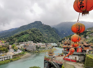
Xinyi Township (信義鄉), Nantou County

Xinyi (信義; literally “Faithfulness [and] Righteousness”) represents two of the Confucian “eight virtues” (see Bade (八德). Drawing on ancient Chinese tradition, this was typical postwar ROC nomenclature, such usages certainly didn’t occur during the Period of Japanese Rule (1895~1945) nor, particularly, during the preceding Qing dynasty (1683~1895).

In the Qing dynasty, this mountainous area had been unsubdued Sheng-Fan (生番; unassimilated Aboriginal) territory, primarily inhabited by Bunun (布農;; Mdn. Bunong) and a few Tsou(鄒; Mdn. Zou) peoples, and, for most of the Japanese era, had been partially subdued lands under the nominal jurisdiction of Taichung Prefecture (台中州; Jpn. Taichūshū).

Yushan (玉山), Taiwan's highest peak at 3952 meters, lies at the border of Xinyi Township with Kaohsiung City's Taoyuan District and Chiayi County's Alishan Township.

Ren-ai Township (仁愛鄉), Nantou County

Ren-ai (仁愛, with a hyphen {or sometimes apostrophe} because Renai could also be Re-nai, e.g. 熱耐 “heat resistant”) means “benevolence [and] love” and therefore represents two of the Confucian “eight virtues” (see Bade (八德). Drawing on ancient Chinese tradition, this was typical of postwar ROC nomenclature; such usages certainly didn’t occur during the Period of Japanese Rule (1895~1945) nor, particularly, during the preceding Qing dynasty (1683~1895).

In the Qing dynasty, this mountainous area had been unsubdued Sheng-Fan (生番; unassimilated Aboriginal) territory, primarily inhabited by Bunun (布農;; Mdn. Bunong), Atayal (泰雅; Mdn. Taiya) and Seediq (賽德克; Mdn. Saideke), and these ethnicities still represent the majority of people today. For most of the Japanese era, this area was partially subdued lands under the nominal jurisdiction of Taichung Prefecture (台中州; Jpn. Taichūshū).

The Wushe (霧社) Rebellion (a.k.a. Masha Incident) of 1930 was one of the last significant uprisings by the Aborigines (or Han-Chinese) against Japanese rule, not just in Nantou County but throughout the whole of Taiwan.


Xinyi District, Taipei City, home to the Taipei World Trade Center, Taipei International Convention Center, former world’s-tallest building Taipei 101, as well as various shopping malls and entertainment venues, is one of Taiwan’s, if not the world’s, most up-market areas.


Xinyi District from Elephant Hill (photo courtesy of Sean Scanlan)

Meaning “Faithfulness [and] Righteousness”, it takes its name from Xinyi Road which runs through the heart of the district, and which represents one-fourth of the Confucian “Eight Virtues” (八德; Ba De). The other six are: loyalty (忠; xhong), filial piety (孝; xiao), benevolence (仁; ren), love (愛; ai), harmony (和; he), and peace (平; ping), and these, in 3 pairs, along with Bade itself, are used for names of five* roads (Bade, Zhongxiao, Ren-ai, Xinyi and Heping) running east-west in central Taipei City, with similar examples in other towns and cities around the island.

As a district name, it dates only from 1990, however. Before that, this area was the southern part of the large Songshan District (松山區), which derived from the Japanese-era name Matsuyama Village (松山庄), to the east of the city boundary, before incorporation in 1938.

Earlier still, this area was known to the Ketagalan Aborigines as Vari Syekkau** (perhaps meaning “where the river bends”***). In 1815** during Qing rule, this was transliterated into Chinese as 麻里折口 (Hoklo: Ba-lí-chek-khau), which was later abbreviated as 錫口 (Hoklo Sek-khau; Mdn. Xikou).


* Actually seven roads, since each of Zhongxiao and Heping are subdivided into West and East roads.

** Abe Akiyoshi
*** Wikipedia

Text and photos copyright Jiyue Publications, 2021/2022


Taoyuan City (formerly Taoyuan County) has a Bade District (formerly “city”) (八德區; named for the Confucian “Eight Virtues”). Before renaming under the postwar ROC administration, this had been called Hachitoku Village (八塊庄) druing the period of Japanese colonial rule (1895-1945), which derived from Bakuaicuo (八塊厝; “Eight Pieces Houses”), which referred to the homesteads of the eight families who opened up the land for farming early in the Qianlong reign period (1736~96).

The eight virtues are loyalty (忠; xhong), filial piety (孝; xiao), benevolence (仁; ren), love (愛; ai), faithfulness (信; xin), righteousness (義; yi), harmony (和; he), and peace (平; ping).


Copyright Jiyue Publications, 2021

Wednesday 29 December 2021

Matsu Islands (馬祖), Fujian (福建) Province

The three dozen Matsu Islands (馬祖列島) are spread out over about 30 km² of sea almost 200km north of Taiwan but less than 20km from China’s Fujian coastline.

Their name derives from the main island, Nangan (南竿; literally “southern pole”), which is also known as Matsu (馬祖; literally “horse ancestor”). This in turn derives from the similarly pronounced seafarers’ deity Mazu (媽祖; “Maternal Ancestor”), an honorific title given to Lin Mo-niang (林默娘; tr. 960-987) who is said to have saved her father (or perhaps brothers) from drowning during her life, and numerous persons afterwards, and whose body is said to have washed ashore here and be buried in the Queen of Heaven Temple (天后宮) on the island. She is worshiped at temples throughout Taiwan (such as at Dajia, Beigang and Tainan, Magong in Penghu, and Taipei’s Guandu and Songshan), as well as in Chinese communities around the world.

Although most Taiwanese people call this archipelago the Matsu Islands, its official name is Lienchiang County (連江; literally “connecting rivers”), the larger part of which is in the PRC (albeit using the simplified characters 连江 and the romanization Lianjiang). In order to overcome this confusion, in 2003 it was proposed to change the islands’ official appellation to Matsu, but this was rejected by a majority of local people, who are said to have suspected it was a pro-independence initiative by the then DPP-led government*.

Matsu's inhabitants also do not speak Holko Taiwanese (which is derived from Southern Min; 閩南語) but, rather, a form of Eastern Min (閩東語) also known as the Fuzhou regionalect.

The Matsu archipelago, along with Kinmen (金門) located around 250km to the southwest, are the only parts of Fujian Province under ROC jurisdiction.

Fujian (福建)

Fujian (福建; literally "good-fortune build”) derives from the names two of its important Tang-dynasty cities: Fuzhou (福州), which still exists, and Jianzhou (建州), which falls within today’s Nanping (南平).


Copyright Caltonhill Publications 2021

*http://www.taipeitimes.com/News/front/archives/2003/04/06/201011

Tuesday 28 December 2021

Juguang (莒光) Township, Matsu Islands, Lienchiang County

Consisting of two major islands, Dongju (東犬; “East Ju”) and Xiju (西莒; “West Ju”), the mini-archipelago of Juguang (莒光; literally “Glory of Ju”) was renamed from Baiquan (白犬; “White Dogs”) in October 1971, the same month that the United Nations switched recognition from the Republic of China (Taiwan) to the People’s Republic of China.

In case this timing might seem coincidental, understanding the linguistic significance of the name will dispel any doubt. Ju was a small, but peaceful and stable, state during the incessant warmongering of China's Spring and Autumn Period (770–476 BCE), more than 2,500 years ago and almost 1,000 miles north of Matsu, in today’s Shandong Province. The king of the neighboring state of Qi (齊) stayed in Ju to prepare a counterattack to take his country back from the State of Yan (燕; based in today’s Beijing) which had invaded it.

The analogy of the ROC vanquishing Mao Zedong and the Chinese Communist Party from the Chinese mainland was obvious for President Chiang Kai-shek, and he made frequent quotation of the idiom 毋忘在莒 (Mdn. wu wang zai ju; “do not forget [the time?] in Ju”).

This also explains the existence of Taiwan’s numerous Juguang Roads (莒光路; such as one in Taipei’s Wanhua District), elementary schools (莒光國小; such as one in New Taipei’s Banqiao District) and other buildings, as well as the Juguanghao (莒光號) second tier of Taiwan’s trains, all commemorating thw“Glory of Ju” (莒光).

It should finally be noted that the Matsu Islands, like Kinmen and Penghu, is not part of Taiwan. Matsu, a.k.a. Lienchiang County (連江縣), was part of Fujian Province, which is now divided, with the larger part being in the PRC, with just Matsu in the ROC. Indeed, the Wade Giles romanization of Lienchiang is retained to differentiate it from the Lianjiang spelling used in China, as is the tradtional full-form version 連江縣 (lienchiang County rather than the PRC's simplified versions of the Chinese characters.

Copyright Jiyue Publications, 2021

Monday 27 December 2021

Yuchi (魚池) Township, Nantou County. and its Sun Moon Lake (日月潭)

Yuchi (魚池; literally “fish pond(s)”) perhaps does not refer to the exapansive Sun Moon Lake (日月潭) within its boundary but, more likely, to the large quantity of smaller ponds and spring water sources that made the fertile area attractive, firstly to Aborigines of the Thao (邵) ethincity who called the area Qabizay, and later to immigrating Han-Chinese, who inititially called it Go-sia-po in Hoklo (五城堡; “Fifth Fort”)

Sun Moon Lake (日月潭; Mdn. Rìyuè tán; Hoklo Ji̍t-goa̍t-thâm) was so-named after its shape, which was said to resemble a circular sun beside a crescent moon, especially before the dam was built, the water level raised, and the central island reduced in size.

It was mentioned as early as 1684 (i.e., immediately following the Qing takeover of Taiwan from the Zheng-family rule) in "MIscellaneous Records of Taiwan” (臺灣雜記) by the first magistrate of Zhuluo County, Li Qi-guang (季麒光) although he is clearly repeating what he had heard and not reporting what he had seen*. [*From wikipedia]

The area around the lake was brought under Qing jurisdiction during the next decade, with today’s Ita-thao (伊達邵; Barawbaw in the Thao language) community of the Thao people on the south shore being recorded as Simadan Community (思麻丹社). By the time of Yu Yong-he’s (郁永河) visit in 1697, he records that the people of this area paid taxes and offered tribute, and mentioned the lake’s Zhuyu (珠嶼; “Pearl Island”).


The Japanese colonial authorities renamed it Tamajima (玉島; “Jade Island”, the postwar KMT-led Nationalist Government called it Guanghua Dao (光華島; “Glory of China Island'), but it is now called by the Thao name Lalu Island (拉魯島; “after/later”).

Nineteenth-century English-language sources refer to Sun Moon Lake it as Lake Candidius after the Dutch missionary Georgius Candidius who proselytized in the Tainan area between 1627 and 1637, and certainly never came near here.

Copyright Jiyue Publications, 2021
Taiwan (台灣)

At first sight, the name Taiwan might seem to mean some kind of “terraced bay” or a “bay with a lookout tower”.

But it turns out that “Taiwan”, like so many names of towns, villages, hills and rivers throughout the island, merely functions for its phonetic not semantic value, that is, it represents a transliteration of a pre-script (i.e. prehistoric) Aboriginal tribe’s name. The meaning of this is lost, but -an, which is a fairly common suffix, perhaps denotes a “place”.

This tribe (i.e., village) was located on a sandbar that is a part of today’s Tainan (台南). This was written in 17th-century Dutch texts as Tayouan (and similar spellings; and later Tywan by the British), and was taken up by Han-Chinese immigrants as Tai-oan, written using 大員 (and similarly-pronounced characters).

The current 臺灣/台灣 became the standard after the Qing court finally defeated the Zheng-family Tongning (東寧) State in 1683, after the latter had kicked the Dutch out in 1662.

Tayouan, that is, Tainan, was where the Dutch East India Company established its headquarters at the beginning of its four-decade stay on Taiwan, and its continued pre-eminent position during the subsequent Han-Chinese colonization of the island presumably accounts for this once-local name coming to represent the whole territory.

Copyright Jiyue Publications, 2021
Guoxing (國姓) Township, Nantou County and its “Sticky Rice Bridge”

At first sight, Guoxing (國姓), literally meaning “national surname”, might seem a strange name for a township. Less so, however, once you know that “Lord of the National Surname” was an honorary title given by one of the last Ming dynasty emperors to Zheng Cheng-gong (see box below) who, followed by his son and grandson, operated a hold-out based on Taiwan from 1661 until 1683 from which, like Chiang Kai-shek three centuries later, they planned to reconquer the Chinese mainland.

In 1670, eight years after Zheng Cheng-gong had died, Zheng Jing (鄭經; 1642~81), his son and successor, sent Liu Guo-xuan (劉國軒) who had fought with his father and would later be Zheng’s chief military official, to quell Aborigines in the mountainous area of today’s Nantou County.

To this end, he established a temporary camp, which he called Guoxing Plain (國姓埔) in honor of Zheng Cheng-gong. Later, when a village formed in or near this area, the name was re-adopted, though Abe says that until renaming under the Japanese administration in 1920, the township was called Neiguoxing (內國姓; “Inner Guoxing”).


Zheng Cheng-gong (鄭成功; 1624~62) who, as part of his support for the Ming emperor in southeastern China after the Manchurian Qing dynasty had been established in Peking and the north, ended up fleeing to Taiwan and, in the process, ousting the Dutch from their four-decade old colony. His name appears frequently in these pages, though not usually as Zheng Cheng-gong, which is how most Taiwanese refer to him, nor Zheng Sen (鄭森), which was his birth name, but as Koxinga, which is how he was known to the Dutch and, subsequently, traditionally in the West.

Zheng’s father, the merchant, pirate and military leader Zheng Zhi-long (鄭芝龍), controlled lands around Fuzhou in Fujian Province, and in 1645 provided a safe place for the new Longwu Emperor (隆武) to establish his throne. Zheng Sen, meanwhile, led Ming loyalist forces against the Qing to the north. For this the emperor gave him the name Cheng-gong (成功; “Success”) and the title Guo-xing Ye (國姓爺; Kok-seng-ia in Hoklo; meanng “Lord of the Imperial Surname”), usually romanized as Koxinga.


Sticky Rice Bridge (糯米橋) at Guoxing Township

In order to improve transportation between its airfields at Puli and Dongshi, the Japanese colonial military constructed a road through mountainous terrain which, when encountering Beigang River (北港溪) in Guoxing Township, in 1940~41 included replacement of an earlier wooden bridge with one of masonry. Traditional local building techniques were used, such as mortar composed of lime, sugar and glutinous rice. This led to the nickname of the Sticky Rice Bridge, which is now officially an alternative to the Beigang River Stone Bridge (北港溪石橋).


Copyright Jiyue Publications, 2021

Sunday 26 December 2021

Caotun 草屯 Township, Nantou County

Until given the name Caotun (草屯; literally "grass barracks") in 1920 during the Period of Japanese Rule, this area was known by the Hoklo Chhau-e-tun (草鞋墩; Mdn. Cao-xie-dun; literally “grass shoe mound”).

The origin of the earlier name is not certain, but is said to derive from the township’s location on the eastern edge of a flat basin where pioneers, porters and commercial travelers would enter and exit the central mountains. Needing stout shoes for the task ahead or wanting to replace damaged shoes on their way down, they perhaps bought new straw sandals, discarding their old ones in an ever-growing mound.

Three popular explanations for this event were: i) soldiers led here by Koxinga being equipped with new straw sandals, which would date it to 1661~62; ii) soldiers involved in the Lin Shuang-wen Incident of 1787~88 (林爽文事件; see Changhua County); or iii) porters carrying salt to Puli late in the Qing dynasty (i.e., late-19th century). But none of these is possible, since Koxinga and his soldiers never came here, and the name was mentioned in official documents as early as 1758.

The Japanese-era renaming not only shortened the three characters to two but also changed 墩 (Hoklo tun; Mdn. dun; “mound”) to 屯 (Hoklo tun; Mdn. tun; “barracks/camp”) in line with similar names in central Taiwan.


Copyright Jiyue Publications, 2021
Guting (古亭), Daan District, Taipei CIty.

Guting literally means “old pavilion”, but apparently was originally written with the similar sounding characters 鼓亭 that meant “drum pavilion”.

According to a stele at the local Changqing Temple (長慶廟), which is supported by Abe Akiyoshi (安倍 明義) in his 1938 publication 台灣地名研究 (Studies on Taiwan's Place Names), a tall drum tower was erected by local immigrants from Fujian Province's Quanzhou Prefecture to keep watch for “marauding Aboriginal headhunters,” whose presence would then be announced by beating a drum to assemble local people.


Text and photos copyright Jiyue Publications, 2021, 2022
Xizhi (汐止), New Taipei City.

Literally meaning “tide’s end”, Xizhi is located at the highest reach of the tidal zone on the Keelung River, some 30 kilometers above the estuary at Danshui.

Pronounced Shiodome in Japanese, this represented the colonial administration’s 1919 gentrification of the area’s earlier Hoklo name of 水返腳 (Tsui-tng-ka; Mdn. Shui-fan-jiao), which, meaning. “water returning site*”, also referred to the estuary tide stopping here before returning to the sea.

There was an earlier Plains Aboriginal village on the south bank of the Keelung River perhaps called something like Kypanas, which was transliterated into Hoklo as 峯仔峙社 (Phang-á-sī-siā) when Han-Chinese immigrants established a settlement around 1758


[*腳 literally "foot" but used for "place"]

Copyright Jiyue Publications, 2021

Saturday 25 December 2021

Gongguan Township (公館鄉) in Miaoli County.

Gongguan, generally referred to the mansion or grand residence of a rich or important person, often the home of the head official in a locality, and so is a very widespread topographical name (see Gongguan, Taipei City).

In this instance, however, the name was only adopted for this part of Miaoli County at the beginning of Japanese colonial rule at the end of the 19th century due, it is said, to the preponderance of government offices and public buildings in this area.


Copyright Jiyue Publications, 2021
Gongguan (公館), Zhongzheng District, Taipei City.

Gongguan is a very common place name in Taiwan, with around 65 examples ranging from single houses and streets to this area of Taipei and Gongguan Township (公館鄉) in Miaoli County, making it the 3rd most widespread topographical name*.

.................... Graffiti in Gongguan recalling Gongguan's former TRA railway station

Literally meaning “public hall” or possibly “duke’s hall”, it generally referred to the mansion or grand residence of a rich or important person, often the home of the head official in a locality.

As such, and in the absence of local government offices, such buildings were used for conducting interactions between local people. This example in Taipei (which in fact was originally located some distance further south, near the confluence of the Jingmei (景美溪) and Xindian (新店溪) rivers), was apparently used for negotations and the collection of farmland rents between Aborigines and immigrating Han-Chinese from the Quanzhou (泉州) area of Fujian Province.


*Professor Lai Chin-kui (賴進貴) of the Department of Geography at National Taiwan University; 2017 National Geographic article.


Text and photo copyright Jiyue Publications, 2021, 2022
Zhushan Township (竹山鎮), Nantou County

Until the Japanese-era renaming in 1920 due to the dense bamboo forests nearby, Zhushan (竹山; “bamboo mountain”) Township was called Lin Yi Village (林圯埔; Hoklo Lim-ki-poo).

In 1665, Zheng Jing (鄭經), son of Koxinga (a.k.a. Zheng Cheng-gong 鄭成功; who had forced the Dutch out of Taiwan, promulgated a system of tun-tian (屯田; military farms) to open land for Han-Chinese agriculture, extending the earlier jun-tun (軍屯; military garrisons) into Aboriginal territories.

In 1668, Lin Yi (林圯), from Tong’an County in Fujian Province who had arrived in Taiwan with Koxinga in 1661, led 200-plus men from Douliumen (斗六門; today’s Douliu City) to attack Gu-sio-tak-kao 牛相觸口 (today’s Zhonghe Neighborhood 中和里), establishing Zhuweizaizhuang (竹圍仔庄; today’s Zhuwei Neighborhood 竹圍里) as his base, and driving out the original inhabitants of the large Luhtu Community (transliterated as 魯富都) of the Tsou ethnicity (鄒族) to Dongpuna (東埔蚋; today’s Yanping Neighborhood 延平里).

Fierce conflicts continued however, and in the 10th lunar month of 1668 Tsou tribespeople counterattacked at night and besieged this base, killing Lin Yi and more than 100 soldier/farmers.

After reinforcements had overcome the Tsou, the settlement was named in Lin Yi’s honour, and went on to become the first Han-Chinese development in the Nantou Area.

Lin’s grave is still tended on Yuying Road (育英路) in downtown Zhushan.


[MC: Could it be possible that the Japanese colonial authorities changed the township's name because the character 圯 is rare in the Japanese lexicon? It's rare enough in Chinese, most people perhaps do not know its pronunciation. Maybe Zhushan would still be named for Lin if his given name was more of a "vegetable market name".]

Copyright Jiyue Publications, 2021